Area Overview for BH20 6JD
Photos of BH20 6JD
Area Information
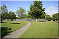
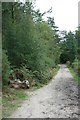
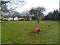
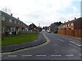
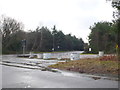
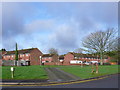
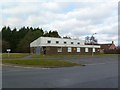
Living in BH20 6JD means inhabiting a quiet, rural cluster of villages in Dorset’s Piddle valley. This postcode area, spanning 36.2 hectares, is home to around 1,642 people, with a population density of just 27 people per square kilometre. The villages of Affpuddle, Turners Puddle, Briantspuddle, and Pallington form a linear settlement of traditional brick, stone, and thatched cottages, divided by the B3390 road. The area’s charm lies in its tranquillity, with farms, historic sites, and the River Piddle shaping daily life. Its history stretches back to the Saxon era, with mentions in the Domesday Book and a legacy of watermeadows and 13th-century churches. For those seeking a peaceful, low-density lifestyle, BH20 6JD offers a blend of rural character and small-community cohesion, far from urban sprawl but within reach of nearby towns like Dorchester. The area’s distinctiveness comes from its preserved heritage, with features like the Grade II-listed Briantspuddle War Memorial and the remnants of a 19th-century model village experiment.
- Area Type
- Postcode
- Area Size
- 36.2 hectares
- Population
- 1642
- Population Density
- 27 people/km²
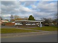
The property market in BH20 6JD is dominated by owner-occupied homes, with 68% of residents owning their properties. The area’s accommodation type is exclusively houses, reflecting its rural, low-density character. This contrasts with urban areas where flats or apartments might predominate. Given the small size of the postcode area—36.2 hectares—and its status as a cluster of villages, the housing stock is limited, with no indication of high-rise developments or large-scale residential projects. For buyers, this means a niche market with fewer properties available, though those on the market are likely to be traditional, well-maintained homes suited to those prioritising space and rural living. The high home ownership rate suggests a community of long-term residents, which may influence the pace of property turnover. Buyers should also consider the area’s proximity to nearby towns for additional amenities, as local services are sparse.
House Prices in BH20 6JD
No properties found in this postcode.
Energy Efficiency in BH20 6JD
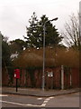
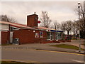
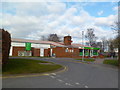
The lifestyle in BH20 6JD is shaped by its rural setting and proximity to small-scale amenities. Within practical reach are retail options like Spar, Co-op Warmwell, and Spar Puddletown, offering essentials for daily living. The B3390 road runs through the area, connecting residents to nearby villages and towns. While the area lacks large supermarkets or entertainment venues, the presence of three railway stations ensures access to larger retail hubs and cultural amenities in nearby centres. The rural character means parks and open spaces are abundant, with the River Piddle and surrounding farmland providing opportunities for walking and outdoor activities. The quiet, low-density environment suits those who prioritise tranquillity over urban convenience, though residents may need to travel further for specialist services or dining options.
Amenities
Schools
The schools nearest to BH20 6JD include Winfrith Church of England First School, a primary school, and Employ My Ability (EMA) Ltd, a special school. These institutions cater to a range of educational needs, from early years to specialist support for students with specific requirements. The presence of both a primary and a special school suggests a community that values inclusive education and provides resources for diverse family needs. However, the absence of secondary schools within the area means families may need to travel to nearby towns like Dorchester or Wareham for secondary education. The mix of school types indicates a focus on tailored learning environments, though parents should plan for commuting to higher education levels. The schools’ specific Ofsted ratings are not provided, so further research would be necessary to assess their performance in detail.
| Rank | School | Type | Entry gender | Ages |
|---|
Explore more schools in this area
Go to Schools tabDemographics
The population of BH20 6JD is predominantly middle-aged, with a median age of 47 and the majority of residents falling within the 30-64 age range. Home ownership is high at 68%, reflecting a community of long-term residents rather than transient renters. The area is characterised by houses rather than flats, aligning with its rural, low-density nature. The predominant ethnic group is White, though specific data on diversity beyond this is not provided. The population density of 27 people per square kilometre underscores the spacious, spread-out character of the area. This demographic profile suggests a stable, family-oriented environment where residents are likely to have established roots. The absence of significant deprivation indicators—such as no mention of high deprivation levels—implies a quality of life that balances simplicity with access to essential services. However, the limited data on diversity means the community’s full composition remains less defined.
Household Size
Accommodation Type
Tenure
Ethnic Group
Religion
Household Composition
Age
Household Deprivation
NS-SEC
Explore more demographic insights in this area
Go to Demographics tabPlanning
Planning Constraints
- Flood RiskPremium
- Ramsar Wetland SitesPremium
- Area of Outstanding Natural BeautyPremium
- Protected Nature ReservePremium
- Protected WoodlandPremium