Area Overview for BH20 6JB
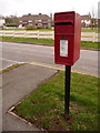
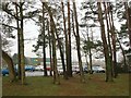
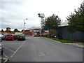
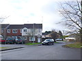
Photos of BH20 6JB


Area Information
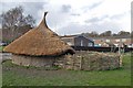
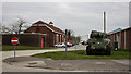
BH20 6JB is a small residential postcode in south Dorset, nestled within the village of Wool, a historic settlement straddling the River Frome. The area covers 43.1 hectares and is home to 2,564 people, with a population density of 402 people per square kilometre. This compact cluster blends rural charm with proximity to nearby towns like Dorchester and Wareham. Wool’s heritage is evident in its medieval bridge and historic churches, while the Bovington Camp military base to the north adds a distinct character. Daily life here is shaped by a mix of quiet residential streets and easy access to local amenities. Families are well-served by nearby schools, and the area’s low crime rates contribute to a sense of security. However, the postcode’s small size means it is tightly integrated with surrounding villages, creating a close-knit community feel. For buyers, BH20 6JB offers a snapshot of rural Dorset living, with a focus on traditional housing and a population skewed toward adults aged 30–64.
- Area Type
- Postcode
- Area Size
- 43.1 hectares
- Population
- 2564
- Population Density
- 402 people/km²
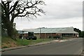
BH20 6JB’s property market is defined by a 40% home ownership rate, indicating that a majority of properties are rented. This suggests a rental market with limited owner-occupied stock, which could make buying a home in the area competitive. The accommodation type is predominantly houses, aligning with the rural character of the postcode. Given the small area size and proximity to Wool and surrounding villages, the housing stock is likely limited, with properties concentrated in traditional, possibly older, homes. Buyers should consider the small footprint of BH20 6JB itself, which means the immediate surroundings—such as Wool’s village centre—play a significant role in property value and desirability. The mix of rental and owner-occupied properties may reflect both local residents and commuters, with demand potentially influenced by nearby towns and transport links.
House Prices in BH20 6JB
No properties found in this postcode.
Energy Efficiency in BH20 6JB
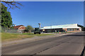
The lifestyle in BH20 6JB is shaped by its proximity to Wool’s village centre, which includes three railway stations and five retail outlets such as Spar and Co-op Warmwell. These amenities provide convenience for daily shopping and travel, though the area’s small size means it is closely tied to surrounding villages. The presence of Wool’s historic sites, including a medieval bridge and churches, adds cultural value to the community. While the data does not mention parks or leisure facilities, the area’s rural setting likely offers outdoor activities in nearby landscapes. The mix of retail options and transport links supports a practical lifestyle, with limited but functional amenities. Residents may rely on nearby towns for more extensive services, but the village’s character and accessibility make it suitable for those prioritising a quiet, connected rural life.
Amenities
Schools
Residents of BH20 6JB have access to several schools, including Bovington Academy, which operates as both a primary school and an academy with a good Ofsted rating. Bovington Middle School is another primary school in the area, offering local education options for younger children. For specialist needs, Harbour School Dorset provides support for students with special educational requirements. The presence of two primary schools and a special school indicates a well-rounded educational infrastructure, catering to a range of family needs. The good Ofsted rating for Bovington Academy suggests a reliable standard of education, which could be a key consideration for families prioritising school quality. The mix of school types ensures coverage for both mainstream and specialist education, supporting a diverse community of learners.
| Rank | School | Type | Entry gender | Ages |
|---|
Explore more schools in this area
Go to Schools tabDemographics
The population of BH20 6JB is 2,564, with a median age of 22, though the most common age range is adults aged 30–64. This suggests a community with a significant proportion of working-age residents, possibly drawn by nearby employment opportunities. Home ownership here stands at 40%, indicating a mix of owner-occupied and rented properties. The predominant accommodation type is houses, reflecting a traditional rural housing stock. The predominant ethnic group is White, with no data provided on other demographics. The population density of 402 people per square kilometre implies a relatively compact settlement, fostering a close-knit environment. While the data does not specify deprivation levels, the low crime score of 78 (out of 100) suggests a generally stable and safe living environment, which could support a quality of life focused on community and local amenities.
Household Size
Accommodation Type
Tenure
Ethnic Group
Religion
Household Composition
Age
Household Deprivation
NS-SEC
Explore more demographic insights in this area
Go to Demographics tabPlanning
Planning Constraints
- Flood RiskPremium
- Ramsar Wetland SitesPremium
- Area of Outstanding Natural BeautyPremium
- Protected Nature ReservePremium
- Protected WoodlandPremium