Area Overview for BH20 5HG
Photos of BH20 5HG
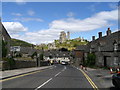
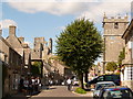
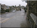
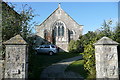
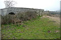
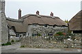
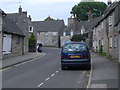
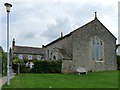
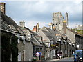
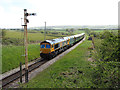
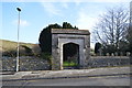
100 photos from this area
Area Information
Key information about the BH20 5HG including its size, population, and administrative classification.
- Area Type
- Postcode
- Area Size
- 2.6 hectares
- Population
- 1694
- Population Density
- 29 people/km²
House Prices in BH20 5HG
30
Properties
£503,333
Average Sold Price
£385,000
Lowest Price
£570,000
Highest Price
Showing 30 properties
| Address | Type | Beds | Baths | Last Sale Price | Last Sale Date | |
|---|---|---|---|---|---|---|
| Collets Cottage, Colletts Close, Corfe Castle, BH20 5HG | house | - | - | £555,000 | Jan 2021 | |
| The Finches, Colletts Close, Corfe Castle, BH20 5HG | Detached | 3 | 2 | £570,000 | Dec 2018 | |
| Castle Keep, Colletts Close, Corfe Castle, BH20 5HG | Detached | - | - | £385,000 | Mar 2005 | |
| 19 Colletts Close, Corfe Castle, BH20 5HG | Detached | 3 | 1 | - | - | |
| 9 Colletts Close, Corfe Castle, BH20 5HG | house | 4 | 3 | - | - | |
| 6 Colletts Close, Corfe Castle, BH20 5HG | Detached | 3 | 2 | - | - | |
| 5 Colletts Close, Corfe Castle, BH20 5HG | Detached | 3 | 2 | - | - | |
| 14 Colletts Close, Corfe Castle, BH20 5HG | Detached | 4 | 1 | - | - | |
| 2 Colletts Close, Corfe Castle, BH20 5HG | Retail | 3 | 1 | - | - | |
| 25 Colletts Close, Corfe Castle, BH20 5HG | Detached | 3 | 2 | - | - |
Page 1 of 3
Energy Efficiency in BH20 5HG
Amenities
Schools
| Rank | School | Type | Entry gender | Ages |
|---|
Explore more schools in this area
Go to Schools tabDemographics
Household Size
Two person
most common
Accommodation Type
Houses
most common
Tenure
60
majority
Ethnic Group
White
most common
Religion
N/A
most common
Household Composition
N/A
most common
Age
47
median
Adults (30-64 years)
most common
Household Deprivation
N/A
with no deprivation
NS-SEC
37
in Lower managerial occupations
Explore more demographic insights in this area
Go to Demographics tabPlanning
Planning Constraints
- Flood RiskPremium
- Area of Outstanding Natural BeautyPremium
- Protected WoodlandPremium