Area Overview for BH20 5AJ
Photos of BH20 5AJ
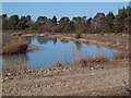
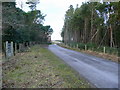
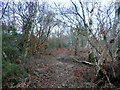
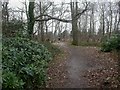
25 photos from this area
Area Information
Key information about the BH20 5AJ including its size, population, and administrative classification.
- Area Type
- Postcode
- Area Size
- 94.5 hectares
- Population
- 1831
- Population Density
- 28 people/km²
House Prices in BH20 5AJ
8
Properties
£747,500
Average Sold Price
£495,000
Lowest Price
£1,000,000
Highest Price
Showing 8 properties
| Address | Type | Beds | Baths | Last Sale Price | Last Sale Date | |
|---|---|---|---|---|---|---|
| Tarrants Lodge, Grange Road, Wareham, BH20 5AJ | Detached | 5 | 2 | £495,000 | May 2011 | |
| Kings Barrow, Grange Road, Wareham, BH20 5AJ | Detached | - | - | £1,000,000 | Jul 2002 | |
| Tarrants Meadow, Grange Road, Wareham, BH20 5AJ | Semi-detached | - | - | - | - | |
| Tarrants, Grange Road, Wareham, BH20 5AJ | Detached | - | - | - | - | |
| Annexe, Tarrants Meadow, Grange Road, Wareham, BH20 5AJ | Flat | - | - | - | - | |
| Little Barrow, Grange Road, Wareham, BH20 5AJ | Detached | 3 | 1 | - | - | |
| Stoborough Croft, Grange Road, Wareham, BH20 5AJ | Detached | - | - | - | - | |
| Little Barrow Cottage, Grange Road, Wareham, BH20 5AJ | Detached | - | - | - | - |
Energy Efficiency in BH20 5AJ
Amenities
Schools
| Rank | School | Type | Entry gender | Ages |
|---|
Explore more schools in this area
Go to Schools tabDemographics
Household Size
Two person
most common
Accommodation Type
Houses
most common
Tenure
78
majority
Ethnic Group
White
most common
Religion
N/A
most common
Household Composition
N/A
most common
Age
47
median
Adults (30-64 years)
most common
Household Deprivation
N/A
with no deprivation
NS-SEC
40
in Lower managerial occupations