Area Overview for BH2 6JS
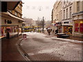
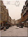
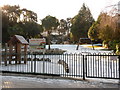
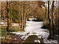
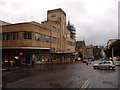
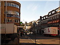
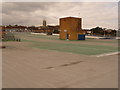
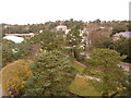
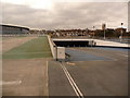
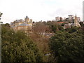
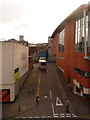
Photos of BH2 6JS

Area Information
Living in BH2 6JS means residing in a compact residential cluster of only 1.9 hectares within the Bournemouth Central ward. This specific postcode holds a population of 1,023 residents, creating a dense environment that forms part of Bournemouth's central business district. The location sits near the coast between West Cliff and East Cliff, placing you at the geographic heart of a historic urban area. Established in 2019 as a distinct electoral ward, this neighbourhood encompasses parts of the town centre, Richmond Hill, and Lansdowne. You are situated just moments from iconic landmarks such as the Royal Exeter Hotel and the Norfolk Royale Hotel, both of which date back to the 19th century. The area also lies close to the Pavilion Theatre and the Bournemouth International Centre. Your daily life is defined by this proximity to significant transport hubs and cultural sites. While the ward experienced a notable tramway accident in 1908, it has since evolved into a significant hub for employment in the wholesale and retail sectors. The intensity of the surroundings reflects the ward's role as the commercial backbone of the town, offering immediate access to the facilities that define Bournemouth's urban character.
- Area Type
- Postcode
- Area Size
- 1.9 hectares
- Population
- 1023
- Population Density
- 53340 people/km²
The property market in BH2 6JS is characterised by a specific housing stock that caters to urban living. Flats are the predominant accommodation type found within this 1.9-hectare area, reflecting the constraints of the town centre location and the density of the 1,023 residents. Only 31 percent of households are owner-occupied, meaning the area operates largely as a rental market. This statistic suggests that finding a property here often involves tenant arrangements rather than purchasing a static home outright. For a buyer looking at homes in BH2 6JS, the inventory likely consists of modern or converted upper-storey units within existing apartment blocks. The high population density of 53,340 people per square kilometre further confirms that single-detached houses are rare in this specific postcode. You are essentially competing in a market driven by investment and city-centre lifestyles. The mix of buyer and landlord occupants means that service charges, lease terms, and building distance from the ground floor are key factors in your decision-making process.
House Prices in BH2 6JS
Showing 68 properties
| Address | Type | Beds | Baths | Last Sale Price | Last Sale Date | |
|---|---|---|---|---|---|---|
| 1, Brompton Court, St Stephens Road, Bournemouth, BH2 6JS | Bungalow | 1 | 1 | £327,500 | Nov 2025 | |
| 3, Brompton Court, St Stephens Road, Bournemouth, BH2 6JS | Bungalow | - | - | £275,000 | May 2024 | |
| 2, Brompton Court, St Stephens Road, Bournemouth, BH2 6JS | Bungalow | 2 | - | £345,000 | Oct 2020 | |
| 8, Brompton Court, St Stephens Road, Bournemouth, BH2 6JS | Flat | 2 | 1 | £330,000 | Mar 2014 | |
| 9, Brompton Court, St Stephens Road, Bournemouth, BH2 6JS | Flat | - | - | £280,000 | Apr 2009 | |
| 6, Brompton Court, St Stephens Road, Bournemouth, BH2 6JS | Flat | - | - | £300,000 | Oct 2008 | |
| 7, Brompton Court, St Stephens Road, Bournemouth, BH2 6JS | Flat | 2 | 1 | £305,000 | Dec 2000 | |
| 40, Brompton Court, St Stephens Road, Bournemouth, BH2 6JS | Retirement | 2 | 1 | - | - | |
| 63, Brompton Court, St Stephens Road, Bournemouth, BH2 6JS | Flat | 2 | 1 | - | - | |
| 25, Brompton Court, St Stephens Road, Bournemouth, BH2 6JS | Flat | 2 | 1 | - | - |
Energy Efficiency in BH2 6JS
Your daily life in BH2 6JS is anchored by immediate access to essential retail and leisure facilities. You are within practical reach of five retail locations, including three branches of Tesco and a Co-op, ensuring daily shopping needs are met without long commutes. Cultural and entertainment options are abundant, with the Pavilion Theatre and Bournemouth International Centre located in the wider ward. Historical sites like the Sacred Heart, St Michael's, and St Swithun's churches add to the local character. Transport links include regular ferry services at Sandbanks and Brownsea Island Ferry Landings, offering easy access to the Isle of Poole. The area is also located near major railway hubs at Bournemouth and Branksome stations. Nearby leisure includes the Tuckton Tea Gardens Ferry Landing and direct routes to Bournemouth International Centre. This concentration of amenities means you can walk to most services, meals, and transport links. The urban setting provides a dense, convenient environment for work and leisure.
Amenities
Schools
| Rank | School | Type | Entry gender | Ages |
|---|
Explore more schools in this area
Go to Schools tabDemographics
The community profile for BH2 6JS is defined by a broad adult demographic with a median age of 47. The most common age range occupies the space between 30 and 64 years, suggesting a settled population rather than one dominated by students or young families. Thirty-one percent of the households are owner-occupied, which indicates that the majority of the population resides there through the rental sector. This mix shapes the feel of the neighbourhood, where transient renters coexist with long-term residents. The accommodation type is predominantly flats, aligning with the high-density nature of the central ward and the local planning history. Regarding diversity, the predominant ethnic group in the data identifies as White, yet the wider Bournemouth Central ward is noted as the most ethnically diverse in Bournemouth. The employed population works largely in wholesale, retail trade, hotels, catering, and financial or insurance sectors. These employment figures highlight the professional nature of the workforce in this specific borough area, fitting the character of a busy town centre location.
Household Size
Accommodation Type
Tenure
Ethnic Group
Religion
Household Composition
Age
Household Deprivation
NS-SEC
Explore more demographic insights in this area
Go to Demographics tabPlanning
Planning Constraints
- Flood RiskPremium
- Ramsar Wetland SitesPremium
- Area of Outstanding Natural BeautyPremium
- Protected Nature ReservePremium
- Protected WoodlandPremium