Area Overview for BH2 5TJ
Photos of BH2 5TJ


Area Information
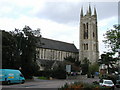
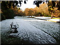
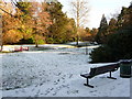
BH2 5TJ is an extremely compact residential cluster in Bournemouth, covering just 942 square metres. Despite its tiny footprint, this postcode serves a population of 1,337 people, creating a very high-density living environment. The ward falls under the Bournemouth, Christchurch and Poole Council area and includes significant urban zones around Bournemouth Town Centre, Richmond Hill, and Lansdowne. You are situated near the coast, positioned between the West Cliff and the East Cliff at approximately 50.7200°N 1.8800°W. This location places you at the heart of the city's central business district. Living in BH2 5TJ means accessing the city's core immediately. The area encompasses historic landmarks such as the Royal Exeter Hotel, built in 1812, and the Norfolk Royale Hotel from 1850. You will find several historic churches nearby, including Sacred Heart from 1874 and St Michael's from 1875. The zone also contains important civic buildings like the Bournemouth Town Hall, constructed in 1885. Historical context for this ward includes a notable tramway accident in 1908 that killed seven people. Today, the character is distinctly urban, blending historical architecture with modern high-density living in a space larger than a typical city block but populated by over a thousand residents.
- Area Type
- Postcode
- Area Size
- 942 m²
- Population
- 1337
- Population Density
- 7411 people/km²
The property market in BH2 5TJ is characterised by a predominance of flats. Accommodation type data confirms that flats form the main housing stock within this postcode. Only 21 per cent of residents own their home. This low figure of ownership suggests a strong rental sector dominates local transactions. You are unlikely to find detached houses or large semi-detached properties in this specific 942 square metre zone. Instead, expect a concentration of multi-unit residential blocks typical of Bournemouth's town centre. Homes in BH2 5TJ cater to the high-density lifestyle required in such a confined urban ward. The vast majority of properties will be flats designed to maximise space within the built-up area. Buyers looking at this area should anticipate a competitive rental market rather than a standard owner-occupier market. The proportion of owner-occupied homes at 21 per cent means investors and landlords form a significant part of the market presence. Prices and values will reflect the urban location and the convenience of central living. While the immediate zone is tiny, the surrounding Bournemouth Central ward offers standard flats common to the city. The nature of this property market requires you to act quickly, as stock turns rapidly in such high-density, rental-heavy environments.
House Prices in BH2 5TJ
Showing 4 properties
| Address | Type | Beds | Baths | Last Sale Price | Last Sale Date | |
|---|---|---|---|---|---|---|
| 9, St Michaels, Norwich Avenue, Bournemouth, BH2 5TJ | Flat | 3 | - | - | - | |
| 7, St Michaels, Norwich Avenue, Bournemouth, BH2 5TJ | Flat | 3 | - | - | - | |
| 10, St Michaels, Norwich Avenue, Bournemouth, BH2 5TJ | Flat | - | - | - | - | |
| 8, St Michaels, Norwich Avenue, Bournemouth, BH2 5TJ | Flat | - | - | - | - |
Energy Efficiency in BH2 5TJ
Life in BH2 5TJ is defined by immediate access to major retail hubs and transport nodes. Within practical reach, you can find five retail outlets including the Co-op Bournemouth and Tesco Bournemouth. These shops are located in Bournemouth and provide all necessary daily goods. Retail options are densely packed around the postcode, ensuring you never need to travel far for essentials. For transport, the area is flanked by five railway stations, including Bournemouth Railway Station and Branksome Railway Station. You can catch trains directly from the doorstep of many flats in this cluster. Leisure and travel options extend further afield but remain accessible. Five ferry terminals are nearby, such as Sandbanks Ferry Terminal and Brownsea Island Ferry Landing, offering easy trips to the islands. Two airports, Bournemouth Airport and Bournemouth International Airport, sit close enough for flight connections. Five cinema and entertainment venues, including the Pavilion Theatre, serve the cultural needs of residents. The area is steeped in history, with landmarks like the Pavilion Theatre from 1929 and the Bournemouth International Centre from 1984. Living in BH2 5TJ gives you instant access to the city's commercial heart. You can shop, eat, and travel without needing a car. The concentration of amenities like the Bournemouth Town Hall and multiple hotels creates a bustling urban environment where everything happens close by.
Amenities
Schools
| Rank | School | Type | Entry gender | Ages |
|---|
Explore more schools in this area
Go to Schools tabDemographics
The community within BH2 5TJ has a median age of 47 years. Residents primarily fall into the adult age range of 30 to 64 years. This profile suggests a demographic skewed towards established households rather than young professionals or retired seniors. Home ownership stands at 21 per cent of the population. This indicates a market dominated by rented accommodation, with only a small fraction of residents owning their homes outright. The predominant ethnic group is White, though research notes the wider ward has significant ethnic diversity. Accommodation types are defined almost entirely by flats. This housing stock matches the high population density relative to the area size. A population density figure of 1,419,863 people per square kilometre highlights the intense concentration of people in this specific postcode. Living here means sharing close proximity with many neighbours in multi-unit buildings. The age profile and rental dominance shape daily interactions. You will find a mix of working-age adults who likely commute to the local wholesale retail and catering sectors. The low ownership rate suggests many residents work temporarily or prefer the flexibility of renting in such a small, highly demanded urban space.
Household Size
Accommodation Type
Tenure
Ethnic Group
Religion
Household Composition
Age
Household Deprivation
NS-SEC
Explore more demographic insights in this area
Go to Demographics tabPlanning
Planning Constraints
- Flood RiskPremium
- Ramsar Wetland SitesPremium
- Area of Outstanding Natural BeautyPremium
- Protected Nature ReservePremium
- Protected WoodlandPremium