Area Overview for BH2 5QL
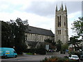
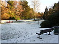
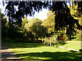
Photos of BH2 5QL


Area Information
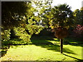
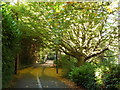
Living in BH2 5QL means inhabiting a small, densely populated residential cluster in Bournemouth’s affluent Westbourne and West Cliff suburbs. The area covers just 1,006 square metres, housing 1,740 people at a density of 1.7 million per square kilometre, reflecting its compact, suburban character. Historically shaped by 19th-century landowners like Sir George Tapps, who planted pine trees to transform the area into a health resort, BH2 5QL today blends heritage with modern convenience. Residents benefit from proximity to Bournemouth’s town centre, with easy access to rail, ferry, and airport links. The ward’s affluent reputation persists, though recent observations note socioeconomic shifts. Daily life is defined by proximity to amenities like the West Cliff Railway, Westbourne Library, and Alum Chine, offering both historical interest and recreational space. This is a place where residential tranquillity meets coastal accessibility, ideal for those seeking a balance between suburban comfort and urban connectivity.
- Area Type
- Postcode
- Area Size
- 1006 m²
- Population
- 1740
- Population Density
- 3735 people/km²
BH2 5QL’s property market is defined by a 58% home ownership rate, with flats making up the majority of accommodation types. This suggests a mix of owner-occupied and rental properties, though the exact proportion of rentals is not specified. The prevalence of flats may indicate a focus on smaller, manageable units, potentially in older housing stock or purpose-built schemes. Given the area’s small size and high density, property options are limited to a tight cluster of residential units. Buyers should consider the compact nature of the area, which may restrict availability of larger homes or land. Proximity to Bournemouth’s amenities and transport links could offset this, making BH2 5QL appealing for those prioritising location over property size.
House Prices in BH2 5QL
No properties found in this postcode.
Energy Efficiency in BH2 5QL
Residents of BH2 5QL have access to a range of amenities within practical reach, including retail outlets like Co-op Bournemouth and Tesco Bournemouth. The area’s rail network, with stations such as Bournemouth Railway Station and Parkstone, ensures easy travel to nearby towns and cities. Ferry terminals like Sandbanks and Shell Bay provide direct access to coastal attractions, while Bournemouth Airport offers regional and international flight connections. The proximity to the West Cliff Railway and Westbourne Library adds to the area’s charm, blending historical interest with modern convenience. This mix of shops, transport, and leisure facilities supports a lifestyle that balances suburban comfort with urban accessibility.
Amenities
Schools
| Rank | School | Type | Entry gender | Ages |
|---|
Explore more schools in this area
Go to Schools tabDemographics
The population of BH2 5QL is 1,740, with a median age of 47 and the majority aged between 30 and 64 years. Home ownership stands at 58%, with flats comprising the predominant accommodation type. The White ethnic group is the largest demographic, though specific diversity statistics are not detailed. The high population density of 1.7 million per square kilometre suggests a compact, closely knit community. This age profile indicates a mature, established population, likely with strong ties to local institutions and services. The relatively high home ownership rate suggests stability, though the flat-dominated housing stock may reflect older properties or purpose-built residential schemes. The area’s character is shaped by its residents’ life stages, with a focus on family living and long-term residency.
Household Size
Accommodation Type
Tenure
Ethnic Group
Religion
Household Composition
Age
Household Deprivation
NS-SEC
Explore more demographic insights in this area
Go to Demographics tabPlanning
Planning Constraints
- Flood RiskPremium
- Ramsar Wetland SitesPremium
- Area of Outstanding Natural BeautyPremium
- Protected Nature ReservePremium
- Protected WoodlandPremium