Area Overview for BH2 5NH
Photos of BH2 5NH


Area Information
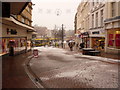
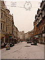
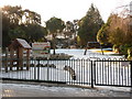
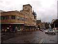
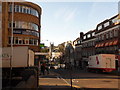
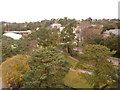
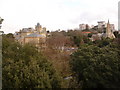
Living in BH2 5NH places you in the heart of Bournemouth’s Central ward, a compact urban area that blends historic charm with modern convenience. This postcode covers a small residential cluster in Bournemouth Town Centre, bordered by coastal landmarks like West Cliff and East Cliff. With a population of 2,453, the area is characterised by its compact size and proximity to the city’s core. The ward includes Richmond Hill and Lansdowne, areas with a mix of historic buildings and contemporary living. Notable features include the Royal Exeter Hotel, St Michael’s Church, and Bournemouth Town Hall, all contributing to a distinct urban identity. While the area is small, it is well-connected, with rail stations, ferry terminals, and two airports within reach. The community here is diverse, with residents working in sectors like retail, hospitality, and finance. However, the area’s compact nature means it is not suited to those seeking expansive green spaces, though its coastal location offers nearby recreational opportunities.
- Area Type
- Postcode
- Area Size
- Not available
- Population
- 2453
- Population Density
- 5494 people/km²
BH2 5NH is a rental-dominated area, with only 35% of homes owned by residents. The accommodation type is predominantly flats, a common feature in urban centres. This suggests a housing stock tailored to smaller households or individuals, rather than larger families. The low home ownership rate indicates that the area is more suited to tenants than buyers seeking long-term investment. For prospective buyers, this could mean limited options for owner-occupied properties, though the compact nature of the postcode might make it easier to find nearby alternatives. The flat-dominated market may also influence property prices, with potential for higher demand in areas offering better amenities or transport links. However, buyers should consider the area’s small size and the need for proximity to other services, as the ward itself offers limited expansion.
House Prices in BH2 5NH
No properties found in this postcode.
Energy Efficiency in BH2 5NH
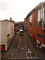
Residents of BH2 5NH have access to a range of amenities within practical reach. Retail options include Tesco Bournemouth and Co-op Bournemouth, providing everyday shopping needs. The area’s proximity to Bournemouth Railway Station, Branksome Railway Station, and Pokesdown Railway Station ensures easy access to public transport. Ferry terminals like Sandbanks Ferry Terminal and Shell Bay Ferry Terminal offer coastal travel, while Bournemouth International Airport is nearby for air travel. The mix of retail, transport, and travel options creates a convenient urban lifestyle. The area’s compact size means residents are close to the town centre’s landmarks, such as the Royal Bath Hotel and Pavilion Theatre. While green spaces are limited within the ward, the coastal proximity offers recreational opportunities. The blend of retail, transport, and cultural amenities supports a dynamic, accessible lifestyle.
Amenities
Schools
The nearest school to BH2 5NH is St Michael’s Church of England Primary School, which serves the area with a primary education offering. The school has an Ofsted rating of ‘good’, indicating a satisfactory standard of teaching and facilities. As the only named school in the data, it is the primary educational option for local families. The absence of secondary schools or other educational institutions within the area suggests that residents may need to travel to nearby wards for further education. For families prioritising primary schooling, St Michael’s provides a reliable option, though the single school choice may limit options for those seeking multiple educational institutions. The ‘good’ rating implies that the school meets acceptable standards, though it does not guarantee exceptional performance.
| Rank | School | Type | Entry gender | Ages |
|---|
Explore more schools in this area
Go to Schools tabDemographics
The population of BH2 5NH is 2,453, with a median age of 47 and the majority of residents aged between 30 and 64. This suggests a community with a strong presence of middle-aged adults, possibly including families and professionals. Home ownership in the area is relatively low at 35%, indicating that a significant proportion of residents are renters. The predominant accommodation type is flats, reflecting the urban character of the ward. The predominant ethnic group is White, though the area is noted for being the most diverse in Bournemouth, suggesting a mix of cultural backgrounds. This demographic profile implies a mature, stable population with a focus on urban living. The lower home ownership rate may influence the property market, making it more rental-focused. For buyers, this could mean limited owner-occupied opportunities, but the area’s amenities and transport links may offset this.
Household Size
Accommodation Type
Tenure
Ethnic Group
Religion
Household Composition
Age
Household Deprivation
NS-SEC
Explore more demographic insights in this area
Go to Demographics tabPlanning
Planning Constraints
- Flood RiskPremium
- Ramsar Wetland SitesPremium
- Area of Outstanding Natural BeautyPremium
- Protected Nature ReservePremium
- Protected WoodlandPremium