Area Overview for BH2 5ND
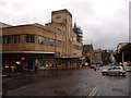
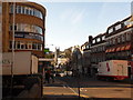
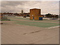
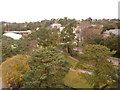
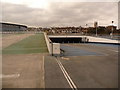
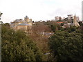
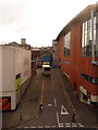
Photos of BH2 5ND


Area Information
BH2 5ND is a small residential postcode in Bournemouth, England, encompassing part of the town’s central district. With a population of 1,337, it is a compact area where urban life meets coastal proximity. The postcode lies between West Cliff and East Cliff, near the heart of Bournemouth’s historic town centre, a hub of activity shaped by its role as a major seaside resort. The area is part of the Bournemouth Central electoral ward, known for its diversity and vibrant commercial landscape. Daily life here is influenced by the surrounding infrastructure, including retail hubs, transport links, and cultural landmarks. The ward’s history includes notable events such as a tramway accident in 1908, underscoring its long-standing significance. Residents benefit from proximity to amenities like Bournemouth Railway Station and the Sandbanks Ferry Terminal, while the area’s character is defined by its mix of historic buildings and modern services. Living in BH2 5ND offers a blend of convenience and coastal charm, though the small size means the community is tightly knit.
- Area Type
- Postcode
- Area Size
- Not available
- Population
- 1337
- Population Density
- 7411 people/km²
The property market in BH2 5ND is characterised by a low home ownership rate of 21%, suggesting that the area is not primarily an owner-occupied market. Instead, it is likely dominated by rental properties, which aligns with the accommodation type being predominantly flats. This housing stock may appeal to individuals or families seeking smaller, managed living spaces rather than detached homes. The small size of the postcode means the available properties are limited, and buyers may need to consider nearby areas for more options. The focus on flats could indicate a demand for convenience and proximity to amenities, such as the nearby Bournemouth Railway Station and retail centres. For those considering purchasing, the low home ownership rate suggests a competitive rental market, but limited availability of owner-occupied properties may present challenges for buyers seeking long-term investment.
House Prices in BH2 5ND
No properties found in this postcode.
Energy Efficiency in BH2 5ND
Living in BH2 5ND offers access to a range of amenities within practical reach. Retail options include major stores such as Tesco Bournemouth and Co-op Bournemouth, ensuring everyday shopping needs are met. The area’s proximity to Bournemouth Railway Station and nearby stations like Branksome and Pokesdown provides easy access to commuting routes. For leisure, the Sandbanks Ferry Terminal and Brownsea Island Ferry Landing offer opportunities for coastal excursions, while Bournemouth International Airport facilitates travel. The area’s urban character is complemented by landmarks such as the Royal Exeter Hotel and Bournemouth Town Hall, adding to its historical and cultural appeal. The mix of retail, transport, and leisure options creates a convenient lifestyle, though the small postcode size means amenities are concentrated rather than spread out. Residents can enjoy a balance of urban convenience and coastal accessibility.
Amenities
Schools
| Rank | School | Type | Entry gender | Ages |
|---|
Explore more schools in this area
Go to Schools tabDemographics
The population of BH2 5ND has a median age of 47, with the most common age range being adults aged 30–64. This suggests a mature, stable community with a focus on established households. Home ownership is low at 21%, indicating that the majority of residents are likely to rent their homes. The accommodation type is predominantly flats, reflecting a housing stock tailored to smaller or multi-generational living. The predominant ethnic group is White, though the ward is noted as the most diverse in Bournemouth, implying a mix of backgrounds despite this statistic. This diversity may influence the area’s cultural and social dynamics. The relatively high median age and low home ownership rate could suggest a population with a mix of long-term residents and transient renters. The data does not indicate specific deprivation levels, but the low home ownership may affect long-term investment in property.
Household Size
Accommodation Type
Tenure
Ethnic Group
Religion
Household Composition
Age
Household Deprivation
NS-SEC
Explore more demographic insights in this area
Go to Demographics tabPlanning
Planning Constraints
- Flood RiskPremium
- Ramsar Wetland SitesPremium
- Area of Outstanding Natural BeautyPremium
- Protected Nature ReservePremium
- Protected WoodlandPremium