Area Overview for BH2 5HW
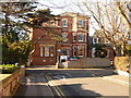
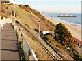
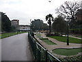
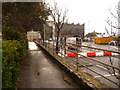
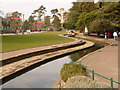
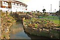
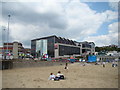
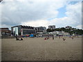
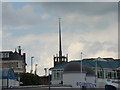
Photos of BH2 5HW


Area Information
Living in BH2 5HW means residing within Westbourne and West Cliff, a residential ward situated on the south west of Bournemouth. This postcode covers a small cluster of homes across an area measuring 1,103 m². With a population of 2,453, the area represents a distinct residential suburb bordering Canford Cliffs in neighbouring Poole. Since 2019, the ward has elected two councillors to Bournemouth, Christchurch and Poole council, reflecting its status as a formal administrative entity. The district has historically evolved from common land used for livestock into a prosperous coastal resort. Sir George Ivison Tapps planted thousands of pine trees on his estate in the early nineteenth century, a development that shaped the region's character. By the late nineteenth century, the area had transformed into an affluent suburban district, supported by historic infrastructure such as the West Cliff Railway opened in 1908. Today, residents enjoy proximity to Alum Chine and the nearby historic property Zetland Court on Alumhurst Road. The ward maintains a balance between independence and access to the wider town centre, offering a quiet suburban environment while remaining close to Bournemouth's amenities.
- Area Type
- Postcode
- Area Size
- 1103 m²
- Population
- 2453
- Population Density
- 5494 people/km²
The property market for BH2 5HW is heavily skewed towards rental occupancy due to the dominance of flats as the primary accommodation type. With only 35 percent home ownership, the majority of the housing stock is likely leased or occupied under other non-freehold arrangements. This statistic strongly suggests that if you are looking for investment properties, this postcode may offer more rental yields relative to owner-occupied rates found in surrounding suburbs. The nature of flats within this 1,103 m² area implies varying unit sizes and shared communal spaces, typical of dense suburban developments. Prospective buyers must navigate a market where purchasing directly into the property is less common than leasing. The area's affluent suburban designation supports higher price points, yet the low ownership figure indicates these values may be driven by high rental demand rather than traditional owner-occupier sales volume. Potential purchasers should expect competition from corporate landlords or private investors given the flat-heavy mix.
House Prices in BH2 5HW
No properties found in this postcode.
Energy Efficiency in BH2 5HW
Daily life in BH2 5HW is defined by immediate access to substantial retail and leisure amenities. Residents can choose from five nearby retail outlets, including Tesco Bournemouth and Co-op Bournemouth, ensuring daily shopping conveniences are within practical reach. Transport options are expansive, with five railway stations including Bournemouth Railway Station and five ferry terminals such as Shell Bay Ferry Terminal just outside the door. Two airports, Bournemouth Airport and Bournemouth International Airport, serve the region, facilitating both local travel and international connections. The historical significance of the West Cliff Railway adds a unique leisure element to the lifestyle, offering scenic access to cliff tops. Westbourne Library provides cultural resources to the community, while nearby Alum Chine and the historic Zetland Court contribute to the area's heritage. The character remains residential and suburban, distinct from the town centre yet maintaining proximity to its facilities.
Amenities
Schools
Families living in BH2 5HW have access to specific educational facilities nearby, with St Michael's Church of England Primary School serving as the key local option. This primary school holds a 'good' Ofsted rating, a standard of quality that trustees and parents regularly assess when choosing their child's education. The presence of a single listed primary school indicates a focused provision for early years education within the immediate vicinity. For secondary education, no data specifies nearby schools in the provided records, meaning families often rely on broader borough catchment areas beyond the immediate postcode. The availability of a rated primary school suggests that this residential cluster prioritises early childhood learning within a controlled, faith-based environment. Parents considering homes in BH2 5HW should verify the current catchment boundaries for St Michael's and plan for secondary schooling elsewhere, as no secondary institutions are listed for this specific area.
| Rank | School | Type | Entry gender | Ages |
|---|
Explore more schools in this area
Go to Schools tabDemographics
The community in BH2 5HW is defined by a mature demographic profile with a median age of 47 years. Most residents fall within the 30 to 64 year age range, indicating a demographic skew towards adults who have settled or downsized rather than young families or retirees. Accommodation in the postcode primarily consists of flats, which dictates the density of housing stock within the small 1,103 m² area. The preference for flats often aligns with the urban, suburban character of Westbourne and West Cliff. Regarding tenure, only 35 percent of residents own their homes outright, meaning a significant majority live in rented accommodation or shared ownership. While specific details on socio-economic deprivation are not quantified in the local datasets, the area is generally characterised as affluent. The predominant ethnic group identified is White. This demographic composition suggests a stable, established community where long-term residents form the core of the local population.
Household Size
Accommodation Type
Tenure
Ethnic Group
Religion
Household Composition
Age
Household Deprivation
NS-SEC
Explore more demographic insights in this area
Go to Demographics tabPlanning
Planning Constraints
- Flood RiskPremium
- Ramsar Wetland SitesPremium
- Area of Outstanding Natural BeautyPremium
- Protected Nature ReservePremium
- Protected WoodlandPremium