Area Overview for BH19 3AH
Photos of BH19 3AH


Area Information
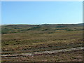
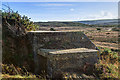
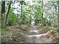
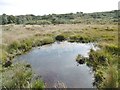
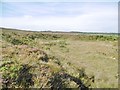
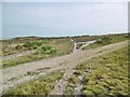
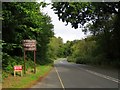
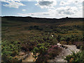
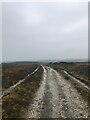
BH19 3AH is a small, distinct postcode area in Studland, a heathland village on the Isle of Purbeck in Dorset. Covering 49.1 hectares and home to 1,694 residents, it is defined by its remote, rural character and environmental protections. The area lies 2 miles north of Swanage and 3 miles south of Sandbanks, near the start of the Jurassic Coast. Historically managed by the Bankes Estate, much of the land is now under the National Trust, preserving its heathland, coastal paths, and conservation areas. Daily life here is shaped by its natural surroundings: Studland Beach, Studland Heath, and the South West Coastal Path are within reach. The village has a seasonal population boost from second homes, but its core community remains rooted in local traditions. With minimal modern development, the area retains a quiet, preserved atmosphere, ideal for those seeking a connection to nature and history.
- Area Type
- Postcode
- Area Size
- 49.1 hectares
- Population
- 1694
- Population Density
- 29 people/km²
BH19 3AH is predominantly a homeowner-occupied area, with 60% of properties owned by residents. The accommodation type is exclusively houses, reflecting the area’s rural and low-density nature. Development is constrained by environmental protections, including the Area of Outstanding Natural Beauty and Ramsar wetland sites, which limit new housing stock. This scarcity of properties means the market is likely to be competitive for buyers, with limited scope for expansion. The National Trust’s management of much of the land further restricts growth, preserving the area’s character but reducing availability for new builds. For buyers, this small postcode area offers a unique opportunity to own a home in a protected, scenic location, though proximity to larger towns like Swanage may be necessary for additional services.
House Prices in BH19 3AH
Showing 4 properties
| Address | Type | Beds | Baths | Last Sale Price | Last Sale Date | |
|---|---|---|---|---|---|---|
| Countryside Office, Access Road To Knoll Beach, Studland, BH19 3AH | Office | - | - | - | - | |
| Tennis 129M From Knoll House Hotel 55M From B3351, Ferry Road, Studland, BH19 3AH | Leisure | - | - | - | - | |
| Tennis 172M From Knoll House Hotel 97M From B3351, Ferry Road, Studland, BH19 3AH | Leisure | - | - | - | - | |
| Staff Accommodation, Knoll House Hotel, Ferry Road, Studland, BH19 3AH | Detached | - | - | - | - |
Energy Efficiency in BH19 3AH
Residents of BH19 3AH have access to a range of amenities within practical reach. Retail options include Budgens Swanage, Co-op Swanage, and Morrisons Daily, while ferry terminals at Shell Bay and Sandbanks provide coastal access. The area’s natural beauty is central to its lifestyle, with Studland Beach, Studland Heath, and the Jurassic Coast offering outdoor activities. The National Trust manages key sites, including Studland Conservation Area and the Studland Heath National Nature Reserve, preserving heathland and wildlife. The village also has a playing field, village green, and a hall for community events. While local retail and dining options are limited, nearby towns like Swanage provide additional facilities. This lifestyle blends rural tranquillity with proximity to coastal attractions, appealing to those who prioritise nature and low-density living.
Amenities
Schools
The nearest schools to BH19 3AH include Corfe Castle Church of England Voluntary Controlled Primary School and Corfe Castle Church of England Primary School, both of which are primary institutions. The latter holds an Ofsted rating of ‘good’. These schools serve the local community and nearby villages, providing education for younger children. However, secondary schooling is not available in Studland, requiring students to travel to larger towns like Swanage or Poole. The presence of two primary schools with positive ratings offers families a reliable start to their children’s education, though parents should plan for transport to secondary schools. The mix of school types reflects the area’s focus on primary education, with limited local provision for older students.
| Rank | School | Type | Entry gender | Ages |
|---|
Explore more schools in this area
Go to Schools tabDemographics
The population of BH19 3AH is 1,694, with a median age of 47 and the majority (60%) of residents aged 30–64. Home ownership stands at 60%, slightly below the UK average, with houses being the predominant accommodation type. The ethnic composition is overwhelmingly White (92% White British in the 2011 census), with limited diversity data available. The area’s demographic profile suggests a mix of working-age adults and retirees, though specific deprivation data is not provided. The presence of second homes, noted in the area’s character overview, may influence seasonal population fluctuations. For families, the community offers a stable, low-density environment, though services and amenities are limited to the village and nearby towns.
Household Size
Accommodation Type
Tenure
Ethnic Group
Religion
Household Composition
Age
Household Deprivation
NS-SEC
Explore more demographic insights in this area
Go to Demographics tabPlanning
Planning Constraints
- Flood RiskPremium
- Ramsar Wetland SitesPremium
- Area of Outstanding Natural BeautyPremium
- Protected Nature ReservePremium
- Protected WoodlandPremium