Area Overview for BH19 3AE
Photos of BH19 3AE


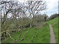
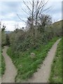
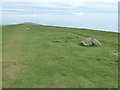
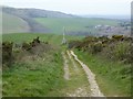

47 photos from this area
Area Information
Key information about the BH19 3AE including its size, population, and administrative classification.
- Area Type
- Postcode
- Area Size
- 44.3 hectares
- Population
- 1694
- Population Density
- 29 people/km²
House Prices in BH19 3AE
27
Properties
£952,956
Average Sold Price
£168,750
Lowest Price
£1,875,000
Highest Price
Showing 27 properties
| Address | Type | Beds | Baths | Last Sale Price | Last Sale Date | |
|---|---|---|---|---|---|---|
| Fauns Cottage, Swanage Road, Studland, BH19 3AE | Detached | 5 | 3 | £1,557,500 | Oct 2023 | |
| White Hills, Swanage Road, Studland, BH19 3AE | Detached | 3 | 2 | £1,615,000 | Mar 2023 | |
| The Spinneys, Swanage Road, Studland, BH19 3AE | Detached | 4 | 3 | £1,500,000 | May 2022 | |
| Avalon, Swanage Road, Studland, BH19 3AE | house | 5 | 1 | £1,625,000 | Jun 2021 | |
| Fairfields, Swanage Road, Studland, BH19 3AE | Detached | 4 | 3 | £1,275,000 | Aug 2020 | |
| Bass Point, Swanage Road, Studland, BH19 3AE | Detached | 5 | 2 | £1,200,000 | Mar 2020 | |
| Isle View, Swanage Road, Studland, BH19 3AE | Detached | 4 | 3 | £1,875,000 | Mar 2018 | |
| Agglestone House, Swanage Road, Studland, BH19 3AE | Detached | 4 | 2 | £750,000 | Sep 2016 | |
| Old Harry House, Swanage Road, Studland, BH19 3AE | Detached | 4 | 5 | £500,000 | Jul 2013 | |
| Ballard Down House, Swanage Road, Studland, BH19 3AE | house | - | - | £560,000 | Mar 2012 |
Page 1 of 3
Energy Efficiency in BH19 3AE
Amenities
Schools
| Rank | School | Type | Entry gender | Ages |
|---|
Explore more schools in this area
Go to Schools tabDemographics
Household Size
Two person
most common
Accommodation Type
Houses
most common
Tenure
60
majority
Ethnic Group
White
most common
Religion
N/A
most common
Household Composition
N/A
most common
Age
47
median
Adults (30-64 years)
most common
Household Deprivation
N/A
with no deprivation
NS-SEC
37
in Lower managerial occupations
Explore more demographic insights in this area
Go to Demographics tabPlanning
Planning Constraints
- Flood RiskPremium
- Ramsar Wetland SitesPremium
- Area of Outstanding Natural BeautyPremium
- Protected Nature ReservePremium
- Protected WoodlandPremium