Area Overview for BH19 2NL
Photos of BH19 2NL
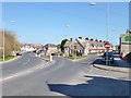
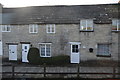
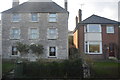
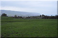
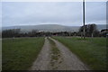
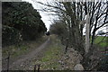
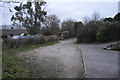
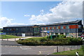
90 photos from this area
Area Information
Key information about the BH19 2NL including its size, population, and administrative classification.
- Area Type
- Postcode
- Area Size
- 6650 m²
- Population
- 1422
- Population Density
- 402 people/km²
House Prices in BH19 2NL
16
Properties
£186,667
Average Sold Price
£80,000
Lowest Price
£245,000
Highest Price
Showing 16 properties
| Address | Type | Beds | Baths | Last Sale Price | Last Sale Date | |
|---|---|---|---|---|---|---|
| 295 High Street, Swanage, BH19 2NL | Semi-detached | 3 | 1 | £245,000 | Feb 2021 | |
| 323 High Street, Swanage, BH19 2NL | house | - | - | £235,000 | Aug 2017 | |
| 299 High Street, Swanage, BH19 2NL | Semi-detached | - | - | £80,000 | Aug 2000 | |
| 311 High Street, Swanage, BH19 2NL | Semi-detached | 3 | 1 | - | - | |
| 293 High Street, Swanage, BH19 2NL | Semi-detached | - | - | - | - | |
| 305 High Street, Swanage, BH19 2NL | Semi-detached | - | - | - | - | |
| 313 High Street, Swanage, BH19 2NL | house | - | - | - | - | |
| 315 High Street, Swanage, BH19 2NL | house | - | - | - | - | |
| 307 High Street, Swanage, BH19 2NL | Semi-detached | - | - | - | - | |
| 321 High Street, Swanage, BH19 2NL | Semi-detached | - | - | - | - |
Page 1 of 2
Energy Efficiency in BH19 2NL
Amenities
Schools
| Rank | School | Type | Entry gender | Ages |
|---|
Explore more schools in this area
Go to Schools tabDemographics
Household Size
Two person
most common
Accommodation Type
Houses
most common
Tenure
66
majority
Ethnic Group
White
most common
Religion
N/A
most common
Household Composition
N/A
most common
Age
47
median
Adults (30-64 years)
most common
Household Deprivation
N/A
with no deprivation
NS-SEC
25
in Lower managerial occupations
Explore more demographic insights in this area
Go to Demographics tabPlanning
Planning Constraints
- Flood RiskPremium
- Ramsar Wetland SitesPremium
- Area of Outstanding Natural BeautyPremium
- Protected Nature ReservePremium
- Protected WoodlandPremium