Area Overview for BH18 8HW
Photos of BH18 8HW
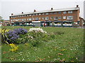
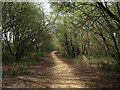
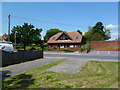
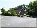
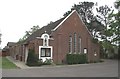
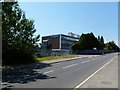
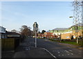
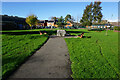
34 photos from this area
Area Information
Key information about the BH18 8HW including its size, population, and administrative classification.
- Area Type
- Postcode
- Area Size
- 1.8 hectares
- Population
- 1773
- Population Density
- 4147 people/km²
House Prices in BH18 8HW
31
Properties
£288,747
Average Sold Price
£75,500
Lowest Price
£480,000
Highest Price
Showing 31 properties
| Address | Type | Beds | Baths | Last Sale Price | Last Sale Date | |
|---|---|---|---|---|---|---|
| 11 Renault Drive, Poole, BH18 8HW | Bungalow | 2 | 1 | £365,000 | Jun 2024 | |
| 26 Renault Drive, Poole, BH18 8HW | Bungalow | 3 | 1 | £480,000 | Sep 2023 | |
| 33 Renault Drive, Poole, BH18 8HW | Bungalow | - | - | £385,000 | Mar 2023 | |
| 7 Renault Drive, Poole, BH18 8HW | Bungalow | - | - | £335,000 | Aug 2021 | |
| 10 Renault Drive, Poole, BH18 8HW | Detached | 2 | 1 | £345,000 | Jan 2021 | |
| 25 Renault Drive, Poole, BH18 8HW | Bungalow | - | - | £342,500 | Nov 2020 | |
| 12 Renault Drive, Poole, BH18 8HW | Bungalow | - | - | £389,500 | Oct 2020 | |
| 20 Renault Drive, Poole, BH18 8HW | Bungalow | 3 | - | £370,000 | Mar 2016 | |
| 17 Renault Drive, Poole, BH18 8HW | Bungalow | 3 | 2 | £314,950 | Oct 2015 | |
| 19 Renault Drive, Poole, BH18 8HW | Bungalow | 2 | 2 | £249,000 | Jun 2014 |
Page 1 of 4
Energy Efficiency in BH18 8HW
Amenities
Schools
| Rank | School | Type | Entry gender | Ages |
|---|
Explore more schools in this area
Go to Schools tabDemographics
Household Size
Two person
most common
Accommodation Type
Houses
most common
Tenure
83
majority
Ethnic Group
White
most common
Religion
N/A
most common
Household Composition
N/A
most common
Age
47
median
Adults (30-64 years)
most common
Household Deprivation
N/A
with no deprivation
NS-SEC
35
in Lower managerial occupations
Explore more demographic insights in this area
Go to Demographics tabPlanning
Planning Constraints
- Flood RiskPremium
- Ramsar Wetland SitesPremium
- Area of Outstanding Natural BeautyPremium
- Protected Nature ReservePremium
- Protected WoodlandPremium