Area Overview for BH17 9HT
Photos of BH17 9HT
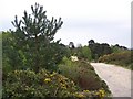
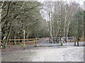
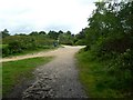
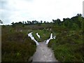
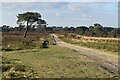
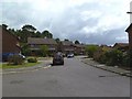
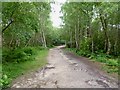
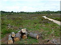
8 photos from this area
Area Information
Key information about the BH17 9HT including its size, population, and administrative classification.
- Area Type
- Postcode
- Area Size
- 5.4 hectares
- Population
- 1300
- Population Density
- 972 people/km²
House Prices in BH17 9HT
20
Properties
£333,635
Average Sold Price
£92,000
Lowest Price
£530,000
Highest Price
Showing 20 properties
| Address | Type | Beds | Baths | Last Sale Price | Last Sale Date | |
|---|---|---|---|---|---|---|
| 101 Pilsdon Drive, Poole, BH17 9HT | Detached | 4 | 2 | £530,000 | May 2023 | |
| 111 Pilsdon Drive, Poole, BH17 9HT | Detached | 4 | 2 | £485,000 | Dec 2022 | |
| 105 Pilsdon Drive, Poole, BH17 9HT | house | - | - | £516,000 | Mar 2022 | |
| 115 Pilsdon Drive, Poole, BH17 9HT | Retail | 4 | 2 | £512,215 | Mar 2022 | |
| 109 Pilsdon Drive, Poole, BH17 9HT | Detached | 5 | 2 | £376,000 | Jun 2016 | |
| 99 Pilsdon Drive, Poole, BH17 9HT | house | - | - | £385,000 | Mar 2016 | |
| 131 Pilsdon Drive, Poole, BH17 9HT | Detached | 4 | - | £367,500 | Nov 2015 | |
| 103 Pilsdon Drive, Poole, BH17 9HT | Detached | 1 | 2 | £330,000 | Sep 2014 | |
| 127 Pilsdon Drive, Poole, BH17 9HT | house | 4 | - | £320,000 | Feb 2014 | |
| 125 Pilsdon Drive, Poole, BH17 9HT | house | - | - | £350,000 | Feb 2010 |
Page 1 of 2
Energy Efficiency in BH17 9HT
Amenities
Schools
| Rank | School | Type | Entry gender | Ages |
|---|
Explore more schools in this area
Go to Schools tabDemographics
Household Size
Two person
most common
Accommodation Type
Houses
most common
Tenure
95
majority
Ethnic Group
White
most common
Religion
N/A
most common
Household Composition
N/A
most common
Age
47
median
Adults (30-64 years)
most common
Household Deprivation
N/A
with no deprivation
NS-SEC
45
in Lower managerial occupations
Explore more demographic insights in this area
Go to Demographics tabPlanning
Planning Constraints
- Flood RiskPremium
- Ramsar Wetland SitesPremium
- Area of Outstanding Natural BeautyPremium
- Protected Nature ReservePremium
- Protected WoodlandPremium