Area Overview for BH17 9BQ
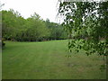
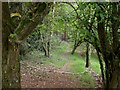
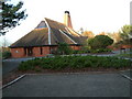
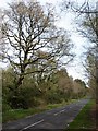
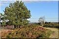
Photos of BH17 9BQ
Area Information
Living in the BH17 9BQ postcode feels distinctly different from larger urban clusters due to its small scale. This specific residential cluster covers 62.3 hectares and supports a population of 1474 people. The density is 188 people per square kilometre, creating a quiet environment that is easier to navigate than wider borough wards. Bearwood and Merley, the wider unitary authority ward, provides further context for the area, encompassing 17.55 square kilometres with a population near 14,000. While your immediate vicinity is intimate, you are situated within the Bournemouth, Christchurch and Poole Council framework. The environment primarily consists of houses rather than high-density flats. You will find a setting that prioritises residential space over commercial sprawl. This postcode represents a specific housing market segment where homeowners have long established roots. The layout supports a slower pace of life compared to busier locations. Daily routines centre around local access points rather than long commutes to distant high streets. The area feels established and stable, reflecting years of settlement rather than rapid development.
- Area Type
- Postcode
- Area Size
- 62.3 hectares
- Population
- 1474
- Population Density
- 188 people/km²
The housing market in BH17 9BQ is defined by a static, owner-occupied character rather than a dynamic rental scene. With 90 per cent of homes owned, the area appeals to those seeking stability and the ability to stay in a property for decades. The accommodation type is exclusively houses, meaning you will not find high-rise apartments or studio flats within this postcode. This limitation is a defining feature of the environment, offering more garden space and single-storey or semi-independent living arrangements compared to urban flats. Buyers looking at homes in this area should expect to compete with local sellers who have deep roots in the community. The small footprint of 62.3 hectares results in a limited selection of properties, potentially restricting choice for those seeking specific modern layouts. The absence of rented stock means the market operates on buying and selling logic rather than tenancy agreements. This structure supports higher median sale prices relative to rental yields, as investors have fewer leverage points here. Property values reflect the dominance of homeownership and the scarcity of available units for immediate move-ins.
House Prices in BH17 9BQ
No properties found in this postcode.
Energy Efficiency in BH17 9BQ
Amenities
Schools
Families living near BH17 9BQ have access to schools that cater to diverse educational needs. Canford School operates as an independent institution nearby, offering an alternative to the state-maintained sector for those seeking private education. For special educational needs, The White House School is nearby and holds a good Ofsted rating. This specific rating indicates a strong standard of care and teaching within its framework. The presence of both an independent school and a special school highlights the area's focus on targeted education rather than a broad mix of primary and secondary public provision. Parents considering schools near this area will find these options provide specialised environments rather than generalist comprehensive settings. The mix suggests that the local community supports both academic independence and specialised support. No other schools are listed as immediate neighbours, which means families often rely on these two key institutions or travel further for mainstream secondary education. The good rating at The White House School provides reassurance for those prioritising specialist backing.
| Rank | School | Type | Entry gender | Ages |
|---|
Explore more schools in this area
Go to Schools tabDemographics
The community in BH17 9BQ skews towards middle age, with a median age of 47 years. Most residents fall into the adult age range between 30 and 64 years. This demographic profile suggests a neighbourhood with significant stability and long-term settlement. Home ownership stands at 90 per cent, indicating that the vast majority of households own their properties outright or with a mortgage rather than renting. The accommodation type is predominantly houses, reinforcing the traditional nature of the housing stock. The predominant ethnic group identified in the area is White, aligning with the broader Southwest England pattern. For families considering homes in this area, the age distribution means neighbours are likely to be settled adults with established lifestyles. The high ownership rate reflects a market where property sellers are less common and resale might take longer than in high-turnover rental regions. The population density of 188 people per square kilometre ensures that daily noise levels remain low. There is no mix of student housing or transient populations, which often disrupts community cohesion in other areas.
Household Size
Accommodation Type
Tenure
Ethnic Group
Religion
Household Composition
Age
Household Deprivation
NS-SEC
Explore more demographic insights in this area
Go to Demographics tabPlanning
Planning Constraints
- Flood RiskPremium
- Ramsar Wetland SitesPremium
- Area of Outstanding Natural BeautyPremium
- Protected Nature ReservePremium
- Protected WoodlandPremium