Area Overview for BH17 8AW
Photos of BH17 8AW


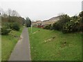
29 photos from this area
Area Information
Key information about the BH17 8AW including its size, population, and administrative classification.
- Area Type
- Postcode
- Area Size
- 2.5 hectares
- Population
- 1430
- Population Density
- 6436 people/km²
House Prices in BH17 8AW
61
Properties
£187,109
Average Sold Price
£42,000
Lowest Price
£375,000
Highest Price
Showing 61 properties
| Address | Type | Beds | Baths | Last Sale Price | Last Sale Date | |
|---|---|---|---|---|---|---|
| 34 Warmwell Close, Poole, BH17 8AW | house | 3 | 1 | £320,000 | Sep 2025 | |
| 40 Warmwell Close, Poole, BH17 8AW | Terraced | 1 | 1 | £210,000 | Jun 2025 | |
| 46 Warmwell Close, Poole, BH17 8AW | Terraced | 2 | 1 | £265,000 | Jan 2025 | |
| 52 Warmwell Close, Poole, BH17 8AW | Terraced | 2 | 1 | £245,000 | Nov 2024 | |
| 31 Warmwell Close, Poole, BH17 8AW | Bungalow | 3 | 2 | £375,000 | Apr 2024 | |
| 45 Warmwell Close, Poole, BH17 8AW | Terraced | 2 | - | £225,000 | May 2022 | |
| 39 Warmwell Close, Poole, BH17 8AW | Detached | 1 | 1 | £187,000 | Dec 2021 | |
| 25 Warmwell Close, Poole, BH17 8AW | Retail | 3 | 1 | £340,000 | Dec 2021 | |
| 55 Warmwell Close, Poole, BH17 8AW | Terraced | 2 | - | £255,000 | Jun 2021 | |
| 3 Warmwell Close, Poole, BH17 8AW | Detached | 3 | 1 | £290,000 | Dec 2020 |
Page 1 of 7
Energy Efficiency in BH17 8AW
Amenities
Schools
| Rank | School | Type | Entry gender | Ages |
|---|
Explore more schools in this area
Go to Schools tabDemographics
Household Size
Family (3-5 people)
most common
Accommodation Type
Houses
most common
Tenure
45
majority
Ethnic Group
White
most common
Religion
N/A
most common
Household Composition
N/A
most common
Age
47
median
Adults (30-64 years)
most common
Household Deprivation
N/A
with no deprivation
NS-SEC
24
in Lower managerial occupations
Explore more demographic insights in this area
Go to Demographics tabPlanning
Planning Constraints
- Flood RiskPremium
- Ramsar Wetland SitesPremium
- Area of Outstanding Natural BeautyPremium
- Protected Nature ReservePremium
- Protected WoodlandPremium