Area Overview for BH17 0SA
Photos of BH17 0SA


Area Information
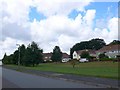
BH17 0SA is a small residential postcode in Poole, Dorset, encompassing part of Canford Heath, a historic heathland and housing development. The area covers just 1.3 hectares, yet it supports a population of 1,300 people, resulting in a remarkably high density of 100,167 people per square kilometre. This compact cluster is part of a larger suburban ward with a population of around 14,000, blending 1960s and 1970s housing with the preserved heathland. The heathland, designated a Site of Special Scientific Interest, is home to rare species like the smooth snake and Dartford warbler, offering a unique natural backdrop to daily life. Residents benefit from proximity to Poole’s amenities, including retail, rail, and ferry services, while the area’s history as a Roman-era pottery site and 20th-century housing project adds depth to its character. Living here means balancing urban convenience with access to protected green space, though the high density may feel intimate rather than sprawling.
- Area Type
- Postcode
- Area Size
- 1.3 hectares
- Population
- 1300
- Population Density
- 1326 people/km²
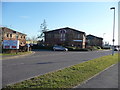
BH17 0SA is predominantly an owner-occupied area, with 74% of homes owned by residents rather than rented. The accommodation type is primarily houses, which is typical of suburban settings in the UK. Given the area’s small size—just 1.3 hectares—and high population density, the housing stock is likely limited to the original 1960s and 1970s developments. This means the market is likely to feature older properties with established gardens and private outdoor space, which may appeal to buyers seeking a quieter, semi-rural lifestyle. However, the compact nature of the postcode means that immediate surroundings, such as nearby Canford Heath, may offer more housing options. Buyers should consider proximity to amenities like schools, rail, and the heathland, as well as the area’s historical character, which may influence property values and desirability.
House Prices in BH17 0SA
No properties found in this postcode.
Energy Efficiency in BH17 0SA
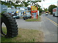
Living in BH17 0SA offers access to a mix of retail, transport, and natural amenities. The area is within walking distance of Co-op Oakdale, Lidl Canford, and Iceland Canford, providing essential shopping and grocery needs. Rail services at Poole, Parkstone, and Hamworthy stations connect residents to broader networks, while ferry terminals offer direct links to Brownsea Island and Poole Quay. The nearby Canford Heath, a Site of Special Scientific Interest, provides walking and recreational opportunities, with rare wildlife like the smooth snake and Dartford warbler. The area also benefits from established community facilities, including schools, churches, and social venues such as The Haymoor and The Pilot public houses. This blend of urban convenience and natural beauty supports a lifestyle that balances accessibility with tranquillity, though the high density may mean shared spaces are used frequently.
Amenities
Schools
| Rank | School | Type | Entry gender | Ages |
|---|
Explore more schools in this area
Go to Schools tabDemographics
The median age in BH17 0SA is 47, with the majority of residents aged between 30 and 64 years. This suggests a mature, established community with a focus on stability. Home ownership is high at 74%, indicating a predominance of long-term residents rather than renters. The accommodation type is primarily houses, reflecting a suburban rather than high-density housing model. The predominant ethnic group is White, aligning with broader demographic trends in the region. The population density of 100,167 people per square kilometre is exceptionally high, which, combined with the age profile, implies a tightly knit community with limited new development. This density may influence local services and amenities, but it also fosters a sense of familiarity among residents. The data does not indicate significant deprivation, but the high ownership rate and age range suggest a population prioritising settled living over transient mobility.
Household Size
Accommodation Type
Tenure
Ethnic Group
Religion
Household Composition
Age
Household Deprivation
NS-SEC
Explore more demographic insights in this area
Go to Demographics tabPlanning
Planning Constraints
- Flood RiskPremium
- Ramsar Wetland SitesPremium
- Area of Outstanding Natural BeautyPremium
- Protected Nature ReservePremium
- Protected WoodlandPremium