Area Overview for BH16 6HY
Photos of BH16 6HY
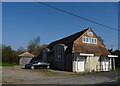
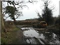
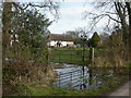
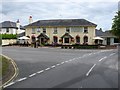
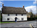
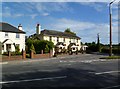
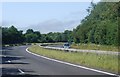
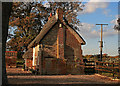
22 photos from this area
Area Information
Key information about the BH16 6HY including its size, population, and administrative classification.
- Area Type
- Postcode
- Area Size
- 9.5 hectares
- Population
- 1929
- Population Density
- 190 people/km²
House Prices in BH16 6HY
21
Properties
£390,563
Average Sold Price
£234,000
Lowest Price
£690,000
Highest Price
Showing 21 properties
| Address | Type | Beds | Baths | Last Sale Price | Last Sale Date | |
|---|---|---|---|---|---|---|
| 19 Ashbrook Walk, Lytchett Minster, BH16 6HY | Detached | 4 | 3 | £640,000 | Jun 2025 | |
| 12 Ashbrook Walk, Lytchett Minster, BH16 6HY | house | - | - | £690,000 | Jun 2021 | |
| 21 Ashbrook Walk, Lytchett Minster, BH16 6HY | Detached | 5 | 3 | £535,000 | Jan 2020 | |
| 14 Ashbrook Walk, Lytchett Minster, BH16 6HY | Semi-detached | 4 | - | £445,000 | Aug 2016 | |
| Woodcutters Cottage, 10 Ashbrook Walk, Lytchett Minster, BH16 6HY | house | 3 | - | £400,000 | Mar 2014 | |
| 6 Ashbrook Walk, Lytchett Minster, BH16 6HY | house | - | - | £405,000 | Apr 2010 | |
| 7 Ashbrook Walk, Lytchett Minster, BH16 6HY | house | - | - | £260,000 | Aug 2009 | |
| 2 Ashbrook Walk, Lytchett Minster, BH16 6HY | Semi-detached | - | - | £345,000 | Oct 2008 | |
| 17 Ashbrook Walk, Lytchett Minster, BH16 6HY | Detached | - | - | £540,000 | Mar 2007 | |
| 8 Ashbrook Walk, Lytchett Minster, BH16 6HY | Semi-detached | 3 | 2 | £280,000 | Jul 2005 |
Page 1 of 3
Energy Efficiency in BH16 6HY
Amenities
Schools
| Rank | School | Type | Entry gender | Ages |
|---|
Explore more schools in this area
Go to Schools tabDemographics
Household Size
Two person
most common
Accommodation Type
Houses
most common
Tenure
86
majority
Ethnic Group
White
most common
Religion
N/A
most common
Household Composition
N/A
most common
Age
47
median
Adults (30-64 years)
most common
Household Deprivation
N/A
with no deprivation
NS-SEC
35
in Lower managerial occupations
Explore more demographic insights in this area
Go to Demographics tabPlanning
Planning Constraints
- Flood RiskPremium
- Ramsar Wetland SitesPremium
- Area of Outstanding Natural BeautyPremium
- Protected Nature ReservePremium
- Protected WoodlandPremium