Area Overview for BH16 6HS
Photos of BH16 6HS
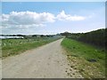
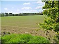
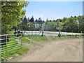
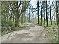
14 photos from this area
Area Information
Key information about the BH16 6HS including its size, population, and administrative classification.
- Area Type
- Postcode
- Area Size
- 1.3 km²
- Population
- 1929
- Population Density
- 190 people/km²
House Prices in BH16 6HS
13
Properties
£454,975
Average Sold Price
£129,950
Lowest Price
£780,000
Highest Price
Showing 13 properties
| Address | Type | Beds | Baths | Last Sale Price | Last Sale Date | |
|---|---|---|---|---|---|---|
| Newton Farmhouse, Dorchester Road, Lytchett Minster, BH16 6HS | Detached | 5 | - | £780,000 | Oct 2015 | |
| 2, Slepe Farm Cottages, Dorchester Road, Lytchett Minster, BH16 6HS | Semi-detached | - | - | £129,950 | Dec 1999 | |
| The Old Granary, Slepe Farm, Dorchester Road, Lytchett Minster, BH16 6HS | Terraced | - | - | - | - | |
| Stable Cottage, Slepe Farm, Dorchester Road, Lytchett Minster, BH16 6HS | Bungalow | - | - | - | - | |
| The Paddocks Slepe Green, Dorchester Road, Lytchett Minster, BH16 6HS | Detached | - | - | - | - | |
| Slepe Green, Dorchester Road, Lytchett Minster, BH16 6HS | Detached | - | - | - | - | |
| 1, Slepe Farm Cottages, Dorchester Road, Lytchett Minster, BH16 6HS | Semi-detached | - | - | - | - | |
| Slepe House, Dorchester Road, Lytchett Minster, BH16 6HS | house | - | - | - | - | |
| Bluebell Meadow Campsite, Wareham Road, Lytchett Matravers, BH16 6HS | commercial | - | - | - | - | |
| Greenworld Cottage, Dorchester Road, Lytchett Minster, BH16 6HS | Bungalow | - | - | - | - |
Page 1 of 2
Energy Efficiency in BH16 6HS
Amenities
Schools
| Rank | School | Type | Entry gender | Ages |
|---|
Explore more schools in this area
Go to Schools tabDemographics
Household Size
Two person
most common
Accommodation Type
Houses
most common
Tenure
86
majority
Ethnic Group
White
most common
Religion
N/A
most common
Household Composition
N/A
most common
Age
47
median
Adults (30-64 years)
most common
Household Deprivation
N/A
with no deprivation
NS-SEC
35
in Lower managerial occupations
Explore more demographic insights in this area
Go to Demographics tabPlanning
Planning Constraints
- Flood RiskPremium
- Ramsar Wetland SitesPremium
- Area of Outstanding Natural BeautyPremium
- Protected Nature ReservePremium
- Protected WoodlandPremium