Area Overview for BH16 5AP
Photos of BH16 5AP
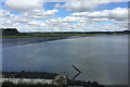
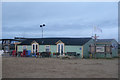
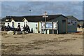
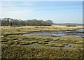
31 photos from this area
Area Information
Key information about the BH16 5AP including its size, population, and administrative classification.
- Area Type
- Postcode
- Area Size
- 61.8 hectares
- Population
- 1929
- Population Density
- 190 people/km²
House Prices in BH16 5AP
32
Properties
£197,025
Average Sold Price
£62,000
Lowest Price
£335,000
Highest Price
Showing 32 properties
| Address | Type | Beds | Baths | Last Sale Price | Last Sale Date | |
|---|---|---|---|---|---|---|
| 100 Egmont Road, Poole, BH16 5AP | Terraced | 3 | 1 | £270,000 | Jun 2025 | |
| 86 Egmont Road, Poole, BH16 5AP | Semi-detached | 3 | 1 | £335,000 | Sep 2024 | |
| 62 Egmont Road, Poole, BH16 5AP | house | - | - | £235,000 | Apr 2021 | |
| 58 Egmont Road, Poole, BH16 5AP | Terraced | 3 | 1 | £225,000 | Apr 2021 | |
| 82 Egmont Road, Poole, BH16 5AP | house | - | - | £250,000 | Mar 2021 | |
| 78 Egmont Road, Poole, BH16 5AP | Semi-detached | 3 | - | £235,000 | Jan 2020 | |
| 84 Egmont Road, Poole, BH16 5AP | house | - | - | £230,000 | Sep 2019 | |
| 74 Egmont Road, Poole, BH16 5AP | house | - | - | £257,000 | Jun 2017 | |
| 64 Egmont Road, Poole, BH16 5AP | Terraced | 3 | 1 | £211,000 | Apr 2017 | |
| 110 Egmont Road, Poole, BH16 5AP | Terraced | 2 | - | £175,000 | Oct 2016 |
Page 1 of 4
Energy Efficiency in BH16 5AP
Amenities
Schools
| Rank | School | Type | Entry gender | Ages |
|---|
Explore more schools in this area
Go to Schools tabDemographics
Household Size
Two person
most common
Accommodation Type
Houses
most common
Tenure
86
majority
Ethnic Group
White
most common
Religion
N/A
most common
Household Composition
N/A
most common
Age
47
median
Adults (30-64 years)
most common
Household Deprivation
N/A
with no deprivation
NS-SEC
35
in Lower managerial occupations
Explore more demographic insights in this area
Go to Demographics tabPlanning
Planning Constraints
- Flood RiskPremium
- Ramsar Wetland SitesPremium
- Area of Outstanding Natural BeautyPremium
- Protected Nature ReservePremium
- Protected WoodlandPremium