Area Overview for BH15 3ZA
Photos of BH15 3ZA


Area Information
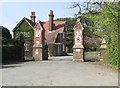
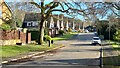
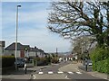
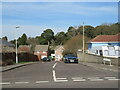
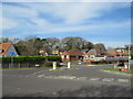
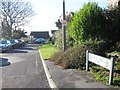
BH15 3ZA is a small residential cluster in Poole, Dorset, part of the Bournemouth, Christchurch and Poole (BCP) unitary authority. With a population of 2,112, it is a quiet suburb characterised by its mix of residential properties and small-scale local businesses. The area includes the Stanley Green neighbourhood and borders several nearby suburbs, such as Parkstone and Canford Heath. Its main road, Wimborne Road (part of the A35), connects directly to Poole Town Centre, offering easy access to the broader region. Daily life here is shaped by its proximity to amenities like St George’s Church, local schools, and recreational spaces. The area’s residential focus, combined with pockets of green space and community facilities, creates a balanced environment for families and individuals seeking a settled lifestyle. Its location near Poole Quay and Bournemouth Airport adds to its appeal for those prioritising connectivity without the bustle of larger towns.
- Area Type
- Postcode
- Area Size
- Not available
- Population
- Not available
- Population Density
- Not available
BH15 3ZA is primarily an owner-occupied area, with 72% of homes owned by residents rather than rented. The accommodation type is predominantly houses, which aligns with the area’s focus on family-sized properties. This suggests a housing stock suited to households requiring more space, such as growing families or individuals seeking a private, low-density environment. The small size of the postcode area means the property market is likely limited in scale, with fewer options available compared to larger towns. Buyers should consider the proximity to Poole and Bournemouth for broader choices, though the local market may offer characterful, traditional homes. The high home ownership rate indicates a stable market, but competition for properties could be fierce due to the area’s limited supply.
House Prices in BH15 3ZA
No properties found in this postcode.
Energy Efficiency in BH15 3ZA
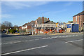
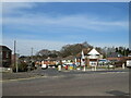
Residents of BH15 3ZA have access to a range of amenities within practical reach. Retail options include Iceland Canford, Morrisons Daily Canford, and Iceland Poole, providing grocery and convenience shopping. The area’s proximity to Poole Quay and ferry terminals enables easy access to coastal activities, while Bournemouth Airport offers regional travel connections. Local leisure options include St George’s Church, play parks, and the large allotment area, fostering community engagement and outdoor recreation. The presence of small businesses, such as pubs and takeaway restaurants, adds to the area’s character. The mix of retail, transport, and green spaces ensures a convenient, balanced lifestyle, blending suburban tranquillity with urban accessibility.
Amenities
Schools
Two independent schools are within reach of BH15 3ZA: Franklyn House School and The New School. Both are fee-paying institutions, offering private education options for families prioritising alternative schooling. The presence of independent schools suggests the area attracts households seeking non-state education, though no Ofsted ratings are provided in the data. Nearby, Stanley Green First School and Oakdale Junior School serve younger children, though these are not explicitly listed in the data. The mix of school types implies a choice between state and private education, catering to diverse family needs. However, the absence of specific performance metrics means prospective buyers must research further to assess academic standards.
| Rank | School | Type | Entry gender | Ages |
|---|
Explore more schools in this area
Go to Schools tabDemographics
The population of BH15 3ZA is predominantly adults aged 30–64, with a median age of 47. This suggests a community of established residents, many of whom may be in their prime working years or nearing retirement. Home ownership is high at 72%, indicating a stable, long-term resident base. The area is characterised by houses rather than flats, reflecting a preference for larger, family-friendly properties. The predominant ethnic group is White, though specific diversity metrics are not provided. The age profile and ownership rates imply a community focused on stability, with fewer transient residents. For families, this suggests a predictable environment with established local networks. The absence of detailed deprivation data means the area’s quality of life remains unquantified, but the demographics point to a mature, settled population.
Household Size
Accommodation Type
Tenure
Ethnic Group
Religion
Household Composition
Age
Household Deprivation
NS-SEC
Explore more demographic insights in this area
Go to Demographics tabPlanning
Planning Constraints
- Flood RiskPremium
- Ramsar Wetland SitesPremium
- Area of Outstanding Natural BeautyPremium
- Protected Nature ReservePremium
- Protected WoodlandPremium