Area Overview for BH15 3EE
Photos of BH15 3EE
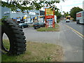
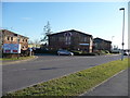
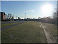
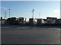
69 photos from this area
Area Information
Key information about the BH15 3EE including its size, population, and administrative classification.
- Area Type
- Postcode
- Area Size
- 3.2 hectares
- Population
- 1612
- Population Density
- 5247 people/km²
House Prices in BH15 3EE
59
Properties
£256,467
Average Sold Price
£78,000
Lowest Price
£445,000
Highest Price
Showing 59 properties
| Address | Type | Beds | Baths | Last Sale Price | Last Sale Date | |
|---|---|---|---|---|---|---|
| 391 Wimborne Road, Poole, BH15 3EE | Retail | 3 | 2 | £365,000 | Dec 2024 | |
| 453 Wimborne Road, Poole, BH15 3EE | Retail | 3 | 1 | £350,000 | Aug 2022 | |
| 455 Wimborne Road, Poole, BH15 3EE | house | - | - | £445,000 | Nov 2021 | |
| 451 Wimborne Road, Poole, BH15 3EE | house | - | - | £318,975 | May 2021 | |
| 469 Wimborne Road, Poole, BH15 3EE | house | - | - | £350,000 | Nov 2020 | |
| 471 Wimborne Road, Poole, BH15 3EE | Detached | 3 | 1 | £300,000 | Oct 2020 | |
| 475 Wimborne Road, Poole, BH15 3EE | Detached | - | - | £259,000 | Jan 2008 | |
| 457 Wimborne Road, Poole, BH15 3EE | Detached | - | - | £258,000 | Aug 2007 | |
| 461 Wimborne Road, Poole, BH15 3EE | house | - | - | £237,500 | Jul 2006 | |
| 473 Wimborne Road, Poole, BH15 3EE | Detached | - | - | £170,000 | Nov 2005 |
Page 1 of 6
Energy Efficiency in BH15 3EE
Amenities
Schools
| Rank | School | Type | Entry gender | Ages |
|---|
Explore more schools in this area
Go to Schools tabDemographics
Household Size
Family (3-5 people)
most common
Accommodation Type
Houses
most common
Tenure
79
majority
Ethnic Group
White
most common
Religion
N/A
most common
Household Composition
N/A
most common
Age
47
median
Adults (30-64 years)
most common
Household Deprivation
N/A
with no deprivation
NS-SEC
30
in Lower managerial occupations
Explore more demographic insights in this area
Go to Demographics tabPlanning
Planning Constraints
- Flood RiskPremium
- Ramsar Wetland SitesPremium
- Area of Outstanding Natural BeautyPremium
- Protected Nature ReservePremium
- Protected WoodlandPremium