Area Overview for BH15 2JB
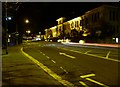
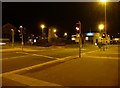
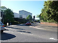
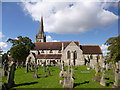
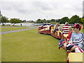
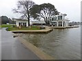
Photos of BH15 2JB


Area Information
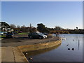
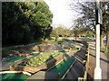
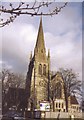
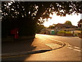
Living in BH15 2JB means being part of Poole Town Ward, a small residential cluster in Poole, Dorset. This area, covering just 1.3 hectares, is densely populated, with 1166 residents per square kilometre, reflecting its compact urban layout. Situated on the northern edge of Poole Harbour, it offers proximity to the sea, with the coastline less than 0.1 kilometres away. The ward includes Poole Town Centre, Longfleet, and Baiter Park, blending historic architecture with modern developments. Daily life here is shaped by its coastal location, with Poole Quay nearby serving as a hub for tourism, maritime heritage, and leisure. The area’s character is defined by its urban coastal setting, where traditional pubs, redeveloped warehouses, and contemporary apartments coexist. With Poole’s status as a gateway to the Jurassic Coast and its ferry links to Brownsea Island, residents enjoy a mix of natural beauty and cultural amenities. The town’s economy, driven by tourism and port activities, supports a range of services, including universities and the RNLI headquarters. For those seeking a compact, accessible coastal lifestyle, BH15 2JB offers a unique blend of history, convenience, and proximity to major transport routes.
- Area Type
- Postcode
- Area Size
- 1.3 hectares
- Population
- Not available
- Population Density
- Not available
The property market in BH15 2JB is characterised by a high proportion of flats, with 61% of homes owner-occupied. This suggests a mix of long-term residents and a rental market catering to the remaining 39%. The compact size of the area—just 1.3 hectares—means housing stock is limited, potentially increasing competition for properties. Flats dominate, which may reflect a blend of older purpose-built housing and newer developments. For buyers, this small postcode area offers a focused selection of properties, but proximity to Poole’s town centre and transport links could drive demand. The presence of Poole’s commercial port and educational institutions like Bournemouth University may attract professionals seeking urban convenience. However, the limited land area means buyers should consider nearby suburbs or extensions of Poole for more options. The market’s reliance on flats may also mean fewer larger family homes are available.
House Prices in BH15 2JB
Showing 18 properties
| Address | Type | Beds | Baths | Last Sale Price | Last Sale Date | |
|---|---|---|---|---|---|---|
| Block D, Poole General Hospital, Longfleet Road, Poole, BH15 2JB | commercial | - | - | - | - | |
| Block J, Poole General Hospital, Longfleet Road, Poole, BH15 2JB | commercial | - | - | - | - | |
| Churchfield House, Poole General Hospital, Longfleet Road, Poole, BH15 2JB | commercial | - | - | - | - | |
| Block F, Poole General Hospital, Longfleet Road, Poole, BH15 2JB | commercial | - | - | - | - | |
| Block B, Poole General Hospital, Longfleet Road, Poole, BH15 2JB | commercial | - | - | - | - | |
| Block A, Poole General Hospital, Longfleet Road, Poole, BH15 2JB | commercial | - | - | - | - | |
| Dorset Cancer Centre, Poole General Hospital, Longfleet Road, Poole, BH15 2JB | commercial | - | - | - | - | |
| Block E, Poole General Hospital, Longfleet Road, Poole, BH15 2JB | commercial | - | - | - | - | |
| Block C, Poole General Hospital, Longfleet Road, Poole, BH15 2JB | commercial | - | - | - | - | |
| Child Development Centre, Poole General Hospital, Longfleet Road, Poole, BH15 2JB | commercial | - | - | - | - |
Energy Efficiency in BH15 2JB
Residents of BH15 2JB have access to a range of amenities within practical reach. Retail options include M&S Poole Hospital, The Southern Co-operative Co, and Morrisons Daily Poole 3-4, offering everyday shopping needs. Three rail stations—Poole, Parkstone, and Hamworthy—provide easy access to regional transport, while ferry services connect to Poole Quay, Brownsea Island, and Saint-Malo, France. Poole Quay itself is a focal point, featuring historic pubs, modern apartments, and tourist attractions. The area’s proximity to the Jurassic Coast and Brownsea Island, a National Trust site, offers outdoor recreation opportunities. The town’s cultural offerings include the Lighthouse arts centre and Bournemouth University, adding to its appeal. With a mix of retail, transport, and natural amenities, BH15 2JB supports a convenient, active lifestyle, blending urban convenience with coastal charm.
Amenities
Schools
| Rank | School | Type | Entry gender | Ages |
|---|
Explore more schools in this area
Go to Schools tabDemographics
The community in BH15 2JB is predominantly elderly, with a median age of 47 and the 65+ age group forming the largest demographic. Home ownership rates stand at 61%, with flats being the primary accommodation type. The predominant ethnic group is White, reflecting the area’s demographic makeup. The high population density—88,257 people per square kilometre—suggests a compact, possibly multi-generational living environment. This age profile implies a community with established residents, potentially prioritising stability and proximity to services. The flat-dominated housing stock may indicate a mix of purpose-built and converted properties, which could influence the character of the area. While the data does not specify deprivation levels, the high ownership rate and age profile suggest a population with long-term ties to the area. However, the lack of diversity in ethnic composition may impact the range of cultural amenities and community dynamics.
Household Size
Accommodation Type
Tenure
Ethnic Group
Religion
Household Composition
Age
Household Deprivation
NS-SEC
Explore more demographic insights in this area
Go to Demographics tabPlanning
Planning Constraints
- Flood RiskPremium
- Ramsar Wetland SitesPremium
- Area of Outstanding Natural BeautyPremium
- Protected Nature ReservePremium
- Protected WoodlandPremium