Area Overview for BH15 1PF
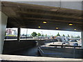
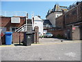
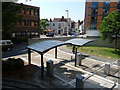
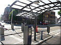
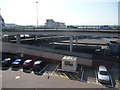
Photos of BH15 1PF

Area Information
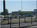
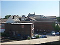
Living in BH15 1PF means being part of a small, tightly knit residential cluster in Poole, a coastal town in Dorset. With a population of 1,343, the area sits on the northern edge of Poole Harbour, a vast natural inlet that opens into the English Channel. The ward includes Poole Town Centre, Longfleet, and Baiter Park, blending urban convenience with proximity to the sea. Daily life here is shaped by the town’s maritime heritage, with Poole Quay serving as a historic and tourist hub. Residents enjoy access to the Jurassic Coast, a UNESCO World Heritage Site, and Brownsea Island, reachable by ferry. The area is defined by its compact size, with homes clustered near retail, transport, and leisure facilities. While Poole is a tourist destination, BH15 1PF offers a quieter residential feel, with a mix of traditional architecture and modern amenities. Its location near major roads, railways, and ferries ensures connectivity to nearby towns like Bournemouth and Christchurch, while the sea remains a constant presence.
- Area Type
- Postcode
- Area Size
- Not available
- Population
- Not available
- Population Density
- Not available
The property market in BH15 1PF is dominated by houses, with 52% of homes owned by residents. This suggests a focus on owner-occupied housing rather than a rental market, though the relatively low ownership percentage indicates some properties are rented. The area’s compact size means housing stock is limited, with homes clustered near Poole’s town centre and surrounding areas. For buyers, this small postcode area offers a mix of traditional and modern housing, often situated close to amenities like Poole Quay and railway stations. The presence of houses rather than flats may appeal to those prioritising space and privacy. However, the limited number of properties means competition could be fierce, especially for desirable locations near the sea or transport links. Buyers should consider the area’s proximity to Poole’s commercial and cultural hubs, which may influence property values and desirability.
House Prices in BH15 1PF
No properties found in this postcode.
Energy Efficiency in BH15 1PF
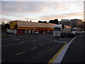
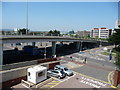
Residents of BH15 1PF enjoy a range of amenities within practical reach, including five major retail outlets like Sainsburys Poole, Asda Poole, and Tesco Poole, ensuring everyday shopping needs are met. The area’s proximity to Poole Quay offers access to historic buildings, modern bars, and the RNLI headquarters, while ferry services provide easy access to Brownsea Island and the Jurassic Coast. Rail connections to Poole, Hamworthy, and Parkstone stations make commuting to nearby towns straightforward. For leisure, the area’s coastal location allows for walking, cycling, or visiting the Blue Flag beaches. The nearby metro stops at Norden and Corfe Castle add cultural and historical attractions. The blend of retail, transport, and natural beauty creates a convenient, dynamic lifestyle, with Poole’s maritime heritage and tourist appeal enhancing daily life.
Amenities
Schools
| Rank | School | Type | Entry gender | Ages |
|---|
Explore more schools in this area
Go to Schools tabDemographics
The community in BH15 1PF is predominantly middle-aged, with a median age of 47 and the most common age range being adults aged 30–64. Home ownership stands at 52%, indicating a mix of owner-occupied properties and rental units. The area is characterised by houses rather than flats, reflecting a preference for single-family homes. The predominant ethnic group is White, with no specific data provided on other demographics. The average household income in the postcode area was £43,200 in 2020, suggesting a stable economic profile. The age profile suggests a mature population, which may influence local services and amenities. With 52% of homes owned outright, the area may appeal to those seeking long-term residency rather than short-term investment. The lack of detailed diversity data means the community’s composition is not fully quantified, but the age and ownership figures paint a picture of a settled, family-oriented neighbourhood.
Household Size
Accommodation Type
Tenure
Ethnic Group
Religion
Household Composition
Age
Household Deprivation
NS-SEC
Explore more demographic insights in this area
Go to Demographics tabPlanning
Planning Constraints
- Flood RiskPremium
- Ramsar Wetland SitesPremium
- Area of Outstanding Natural BeautyPremium
- Protected Nature ReservePremium
- Protected WoodlandPremium