Area Overview for BH15 1HD
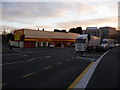
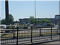
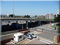
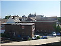
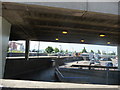
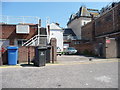
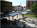
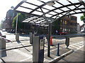
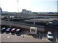
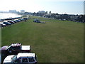
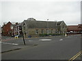
Photos of BH15 1HD

Area Information
BH15 1HD is a small, densely populated residential cluster in Poole, Dorset, situated on the edge of Poole Harbour, a vast natural harbour opening into the English Channel. The area covers 6,674 square metres, housing 1,188 people in a high-density layout typical of urban coastal towns. Its proximity to the sea and the town’s historic maritime heritage shape daily life, with Poole Quay just south of the town centre serving as a cultural and commercial hub. The ward includes Longfleet and Baiter Park, areas that blend modern apartment blocks with historic architecture. Poole’s economy thrives on tourism, port activities, and nearby educational institutions like Bournemouth University and the Arts University. Residents benefit from easy access to ferry services, rail links, and the Jurassic Coast, a UNESCO World Heritage Site. While the area’s compact size means limited green space, its location offers a mix of coastal scenery, retail, and maritime history. The population’s median age of 47 suggests a mature community, with a focus on stability and proximity to amenities.
- Area Type
- Postcode
- Area Size
- 6674 m²
- Population
- Not available
- Population Density
- Not available
BH15 1HD is a rental-dominated area, with only 27% of homes owned by residents. The accommodation type is predominantly flats, reflecting the high population density and urban layout. This suggests a housing stock tailored to smaller, multi-unit buildings rather than detached homes. The small size of the postcode area means the property market is limited, with buyers likely needing to look beyond BH15 1HD for larger or more varied options. The high proportion of rented flats may indicate a transient population or a focus on short-term tenancies. For buyers, this could mean competition for a limited number of properties, with prices potentially influenced by Poole’s broader market, where average property prices in Bournemouth were £358,229 in 2020.
House Prices in BH15 1HD
Showing 1 properties
| Address | Type | Beds | Baths | Last Sale Price | Last Sale Date | |
|---|---|---|---|---|---|---|
| The Quay Thistle Hotel, The Quay, Poole, BH15 1HD | hotel | - | - | - | - |
Energy Efficiency in BH15 1HD
Residents of BH15 1HD have access to a range of amenities within walking or short driving distance. Retail options include major supermarkets like Tesco Poole, Sainsburys Poole, and Aldi Poole, ensuring daily essentials are readily available. The area’s coastal location offers leisure opportunities at Poole Quay, where historic buildings, pubs, and waterfront attractions blend with modern amenities. Ferry terminals provide access to Brownsea Island and the Channel Islands, while rail links connect to Bournemouth and beyond. The nearby Jurassic Coast and Poole Harbour offer outdoor activities, and the presence of Bournemouth University and the RNLI headquarters adds to the town’s cultural and economic vibrancy. This mix of retail, transport, and natural attractions supports a convenient, active lifestyle.
Amenities
Schools
| Rank | School | Type | Entry gender | Ages |
|---|
Explore more schools in this area
Go to Schools tabDemographics
The population of BH15 1HD is 1,188, with a population density of 177,993 people per square kilometre, reflecting a tightly packed urban environment. The median age is 47, with the most common age range being adults aged 30–64, indicating a community of established professionals and families. Home ownership in the area is low at 27%, suggesting a majority of residents are renters. The predominant accommodation type is flats, aligning with the high density and urban character of the postcode. The predominant ethnic group is White, with no data provided on other demographics. This profile suggests a stable, middle-aged population living in rented flats, likely prioritising proximity to Poole’s amenities over property ownership. The lack of diversity in ownership and ethnicity may indicate limited social or economic mixing within the area.
Household Size
Accommodation Type
Tenure
Ethnic Group
Religion
Household Composition
Age
Household Deprivation
NS-SEC
Explore more demographic insights in this area
Go to Demographics tabPlanning
Planning Constraints
- Flood RiskPremium
- Ramsar Wetland SitesPremium
- Area of Outstanding Natural BeautyPremium
- Protected Nature ReservePremium
- Protected WoodlandPremium