Area Overview for BH14 9YN
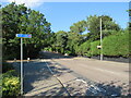
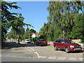
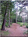
Photos of BH14 9YN


Area Information
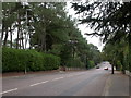
Living in BH14 9YN means being part of a tightly knit seaside community in Poole, Dorset. This postcode area, part of the Canford Cliffs Ward, is a small residential cluster with a population of 1,837 people spread across 1.1 km², creating a dense, compact living environment. Historically a Victorian-era estate, the area was developed in 1886 by Bournemouth businessmen who transformed rugged heathland into a planned residential community. Today, it retains its character as an affluent seaside locale, with large south-facing properties and modern flats coexisting. The area is defined by its proximity to the coast, offering access to watersports like sail boarding and scenic cliffs. While many homes are permanent residences, a significant portion are holiday flats or second homes, reflecting its appeal as both a year-round and seasonal destination. The mix of historic and contemporary architecture, combined with proximity to Bournemouth and Poole, makes BH14 9YN a unique blend of coastal charm and practical connectivity.
- Area Type
- Postcode
- Area Size
- Not available
- Population
- 1837
- Population Density
- 1642 people/km²
The property market in BH14 9YN is dominated by flats, with 69% of homes owned by residents rather than rented. This reflects a balance between owner-occupied properties and rental units, though the data does not specify the proportion of rental homes. The area’s housing stock includes both historic Victorian and Edwardian properties and modern developments, particularly in higher-density blocks. This mix creates a dynamic market where buyers may find a range of options, from older, characterful flats to newer, more contemporary units. The presence of second homes and holiday flats also influences the local property landscape, potentially affecting demand and pricing. For buyers, the area’s compact size means proximity to amenities and transport links is a key consideration, though the small postcode area limits the availability of larger properties.
House Prices in BH14 9YN
No properties found in this postcode.
Energy Efficiency in BH14 9YN
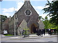
Living in BH14 9YN offers access to a range of amenities within practical reach. Retail options include major supermarkets like Tesco Canford, Asda Poole, and Tesco Lilliput, ensuring everyday shopping needs are met. The area’s proximity to Poole and Bournemouth provides additional retail and dining choices. Residents can also reach ferry terminals for coastal excursions and three railway stations for commuting. The nearby watersports facilities, particularly sail boarding, highlight the area’s leisure opportunities, while historic sites like Holy Angels Church and the Martello Tower add cultural value. The mix of retail, transport, and recreational amenities creates a convenient lifestyle, blending coastal living with practical connectivity.
Amenities
Schools
The nearest school to BH14 9YN is Victoria Education Centre, a special school catering to students with specific educational needs. No other schools are listed in the data, meaning families may need to look beyond the immediate area for primary or secondary education. The presence of a special school highlights the area’s focus on supporting diverse educational requirements, though it does not provide a full range of school types. Parents seeking a broader selection of schools may need to consider nearby towns such as Poole or Bournemouth, which have more extensive educational infrastructure. The single listed school suggests that the community’s educational needs are partially met through specialist provision, but broader options are not locally available.
| Rank | School | Type | Entry gender | Ages |
|---|
Explore more schools in this area
Go to Schools tabDemographics
The population of BH14 9YN is 1,837, with a median age of 47 and the majority (69%) of residents aged between 30 and 64. This suggests a community of middle-aged and older adults, likely with established careers and families. Home ownership is high at 69%, indicating a stable, long-term resident base, though the accommodation type is predominantly flats, which may reflect the area’s shift toward higher-density living. The predominant ethnic group is White, with no specific data on diversity beyond this. The age profile and home ownership rates imply a mature, settled population, though the presence of flats and second homes suggests a mix of permanent residents and seasonal occupants. The area’s demographic makeup aligns with its character as a residential seaside community, where property ownership and long-term residency are common.
Household Size
Accommodation Type
Tenure
Ethnic Group
Religion
Household Composition
Age
Household Deprivation
NS-SEC
Explore more demographic insights in this area
Go to Demographics tabPlanning
Planning Constraints
- Flood RiskPremium
- Ramsar Wetland SitesPremium
- Area of Outstanding Natural BeautyPremium
- Protected Nature ReservePremium
- Protected WoodlandPremium