Area Overview for BH14 9EG
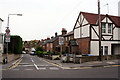
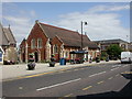
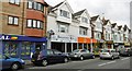
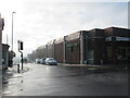
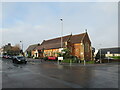
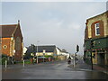
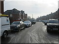
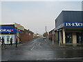
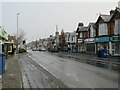
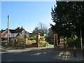
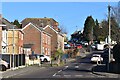
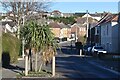
Photos of BH14 9EG
Area Information
BH14 9EG is a small residential postcode area in Poole, Dorset, encompassing parts of Penn Hill and Parkstone. With a population of 1,858, it is a compact cluster of homes situated near key local landmarks such as Alexandra Park and St Aldhelm’s Church, Poole. The area is closely linked to Parkstone, Branksome, and Sandbanks, which contribute to its proximity to coastal and suburban amenities. Daily life here is shaped by its integration with nearby transport hubs, including Branksome Railway Station and Poole Quay Ferry Landing, offering easy access to regional travel. The postcode’s character is defined by its mix of residential tranquility and connectivity to larger urban centres. Residents benefit from proximity to retail outlets like Iceland Parkstone and Waitrose, as well as recreational spaces such as Alexandra Park, which hosts a historic bowling green. The area’s small size means it is tightly woven into the broader Poole and Bournemouth networks, blending suburban comfort with coastal accessibility.
- Area Type
- Postcode
- Area Size
- Not available
- Population
- 1858
- Population Density
- 8768 people/km²
The property market in BH14 9EG is characterised by a high proportion of owner-occupied homes, with 61% of properties owned by residents. This suggests a stable housing market with a focus on long-term residency rather than short-term rental investment. The accommodation type is predominantly houses, which aligns with the area’s suburban and semi-rural character. This contrasts with larger urban centres where flats and apartments dominate. The small postcode area means the housing stock is limited, and properties are likely to be in close proximity to one another. For buyers, this implies a niche market with limited availability, but also potential for stable property values given the area’s connectivity to Poole and Bournemouth. The presence of nearby amenities such as rail stations and retail hubs may also enhance the appeal of owner-occupied homes here.
House Prices in BH14 9EG
No properties found in this postcode.
Energy Efficiency in BH14 9EG
Living in BH14 9EG offers access to a range of amenities within walking or short driving distance. Retail options include Iceland Parkstone, Waitrose Parkstone, and Tesco Parkstone, providing everyday shopping convenience. The area’s proximity to Branksome Railway Station and Poole Quay Ferry Landing ensures easy access to regional transport, while Bournemouth Airport and Bournemouth International Airport cater to broader travel needs. Recreational opportunities include Alexandra Park, a local green space with historical significance, and St Aldhelm’s Church, a Grade II* listed site. The nearby coastal areas of Sandbanks and Parkstone add to the area’s appeal, offering scenic walks and leisure activities. This combination of retail, transport, and green spaces creates a balanced lifestyle, blending suburban comfort with coastal accessibility.
Amenities
Schools
| Rank | School | Type | Entry gender | Ages |
|---|
Explore more schools in this area
Go to Schools tabDemographics
The population of BH14 9EG is predominantly adults aged 30–64, with a median age of 47. This suggests a mature, stable community with a strong presence of families and long-term residents. Home ownership rates are 61%, indicating a mix of owner-occupied properties and rentals, though the majority of homes are houses rather than flats or apartments. The predominant ethnic group is White, reflecting the broader demographic patterns of the Poole area. The absence of specific data on deprivation or income levels means no direct conclusions can be drawn about economic hardship, but the age profile and home ownership figures imply a relatively settled, middle-aged population. The area’s small size and residential focus suggest a low turnover of residents, contributing to a sense of continuity in local social networks.
Household Size
Accommodation Type
Tenure
Ethnic Group
Religion
Household Composition
Age
Household Deprivation
NS-SEC
Explore more demographic insights in this area
Go to Demographics tabPlanning
Planning Constraints
- Flood RiskPremium
- Ramsar Wetland SitesPremium
- Area of Outstanding Natural BeautyPremium
- Protected Nature ReservePremium
- Protected WoodlandPremium