Area Overview for BH14 8XY
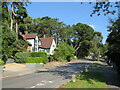
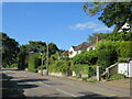
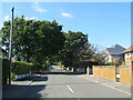
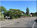
Photos of BH14 8XY
Area Information
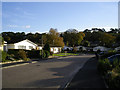
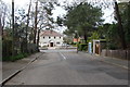
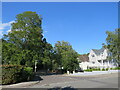
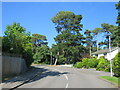
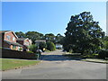
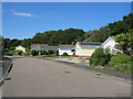
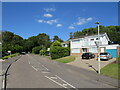
BH14 8XY, part of Penn Hill in Poole, Dorset, is a small residential cluster with a population of 1,550. Situated within the Bournemouth, Christchurch and Poole (BCP) unitary authority, it borders areas like Parkstone, Sandbanks, and Lilliput, creating a tight-knit community feel. The area is served by Branksome Railway Station, which connects to the South West Main Line, offering links to London Waterloo. Penn Hill’s proximity to Poole Quay and Brownsea Island ferry terminals adds to its accessibility. Daily life here is shaped by its mix of residential calm and practical connectivity. The median age of 47 suggests a mature, stable population, with most residents aged 30–64. Home ownership is high at 92%, reflecting a community of long-term residents. The area’s small size means amenities are concentrated, with nearby shops, rail links, and green spaces like Alexandra Park. While it lacks major urban sprawl, its integration with Poole’s infrastructure ensures convenience without sacrificing a quieter lifestyle.
- Area Type
- Postcode
- Area Size
- Not available
- Population
- 1550
- Population Density
- 1770 people/km²
BH14 8XY is a predominantly owner-occupied area, with 92% of homes owned outright. The accommodation type is exclusively houses, reflecting a low-density, suburban layout typical of Poole’s outskirts. This contrasts with areas where flats or apartments dominate, and it suggests a market where property buyers are likely to seek long-term investment rather than short-term rental opportunities. The high home ownership rate means the area is less influenced by rental demand, which could affect price stability. For buyers, this means a focus on individual homes with gardens, a feature that aligns with the area’s residential character. The small size of the postcode area means properties are likely to be distinct, with limited repetition in styles or sizes. Proximity to Poole’s amenities and transport links adds to the appeal, though the lack of high-rise or shared housing options may limit options for those seeking alternative living arrangements.
House Prices in BH14 8XY
No properties found in this postcode.
Energy Efficiency in BH14 8XY
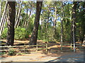
Living in BH14 8XY offers access to a range of practical amenities within easy reach. Retail options include Asda Poole, Spar Sandbanks, and Tesco Lilliput, providing everyday shopping needs. The area’s rail stations—Branksome, Parkstone, and Poole—connect residents to broader networks, while ferry terminals at Poole Quay and Brownsea Island offer maritime travel opportunities. Alexandra Park, a local green space, adds recreational value, with its historical bowling green and pavilion. Nearby, St Aldhelm’s Church in Branksome offers cultural and historical interest. The combination of shops, transport, and open spaces creates a balanced lifestyle, blending suburban tranquility with urban accessibility. Residents can enjoy a mix of convenience and charm, with no need to travel far for essentials or leisure.
Amenities
Schools
| Rank | School | Type | Entry gender | Ages |
|---|
Explore more schools in this area
Go to Schools tabDemographics
The population of BH14 8XY is predominantly adults aged 30–64, with a median age of 47. This suggests a community of established professionals and families, many of whom are likely to have lived in the area for years. Home ownership is exceptionally high at 92%, indicating a strong preference for long-term residency over renting. The accommodation type is primarily houses, which aligns with the area’s residential character and the absence of high-density housing. The predominant ethnic group is White, though no specific data on diversity or deprivation is provided. The age profile and ownership rates suggest a stable, low-turnover community where property values are likely to hold their worth. For buyers, this means a market dominated by owner-occupied homes, with limited rental stock. The demographic profile also implies a focus on family-friendly amenities and services tailored to middle-aged residents.
Household Size
Accommodation Type
Tenure
Ethnic Group
Religion
Household Composition
Age
Household Deprivation
NS-SEC
Explore more demographic insights in this area
Go to Demographics tabPlanning
Planning Constraints
- Flood RiskPremium
- Ramsar Wetland SitesPremium
- Area of Outstanding Natural BeautyPremium
- Protected Nature ReservePremium
- Protected WoodlandPremium