Area Overview for BH14 8JP
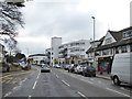
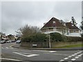
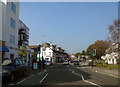
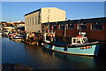
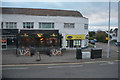
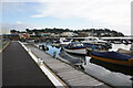
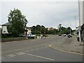
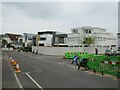
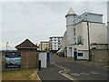
Photos of BH14 8JP


Area Information
BH14 8JP is a small residential postcode in Poole, Dorset, encompassing the Penn Hill area. With a population of 1,783 and a high density of 1,764 people per square kilometre, this compact cluster of homes reflects a tight-knit community. The area is bordered by Branksome Park, Canford Cliffs, Sandbanks, and Lilliput, placing it within a broader network of coastal and suburban neighbourhoods. Daily life here is shaped by proximity to Poole’s amenities, including its historic landmarks and transport links. The ward is part of the Poole parliamentary constituency and elects two councillors to the Bournemouth, Christchurch and Poole Council. While the area lacks detailed historical records, its modern infrastructure and connections to nearby towns suggest a practical, functional lifestyle. Residents benefit from nearby Alexandra Park, a green space with historical features like a 1920s bowling green, and access to Branksome railway station, which links to the South West Main Line. Living in BH14 8JP means balancing suburban comfort with coastal accessibility, though the area’s small size means its character is defined by its immediate surroundings.
- Area Type
- Postcode
- Area Size
- Not available
- Population
- 1783
- Population Density
- 1764 people/km²
The property market in BH14 8JP is characterised by high home ownership (88%) and a predominance of houses, reflecting a residential area with limited rental activity. This suggests that the area is primarily occupied by owner-occupiers rather than tenants, which may influence the types of properties available. The focus on houses rather than flats or apartments indicates a demand for larger, more private living spaces, possibly appealing to families or those seeking suburban comfort. Given the small size of the postcode and its proximity to Poole, the immediate surroundings likely offer similar housing stock, though specific data on property prices or availability is not provided. Buyers should consider that the area’s compact nature may limit options for those seeking larger plots or newer developments. The high home ownership rate also implies a stable market, with fewer fluctuations compared to areas with higher rental turnover.
House Prices in BH14 8JP
No properties found in this postcode.
Energy Efficiency in BH14 8JP
Residents of BH14 8JP have access to a range of local amenities within practical reach. Retail options include major chains such as Tesco Lilliput, Asda Poole, and Spar Sandbanks, ensuring everyday shopping needs are met. The area’s proximity to Poole’s transport hubs, including Branksome railway station, enhances connectivity to larger towns and cities. Leisure opportunities include Alexandra Park, a green space with historical features like a 1920s bowling green, which offers recreational space for residents. The nearby St Aldhelm’s Church, a Grade II* listed building, adds cultural and historical interest to the area. While the data does not specify dining or entertainment venues, the presence of multiple retail and transport options suggests a functional lifestyle focused on convenience and accessibility. The mix of retail, transport, and green spaces indicates a balanced approach to daily living, though the absence of detailed information on dining or leisure facilities means their impact on lifestyle is not fully quantified.
Amenities
Schools
Residents of BH14 8JP have access to two primary schools within proximity. The Lilliput Church of England Voluntary Controlled Infant School is a traditional primary school, while the Lilliput Church of England Infant School is an academy with an Ofsted rating of 'good'. Both institutions serve the same area, offering parents a choice between a voluntary controlled school and an academy model. The presence of two schools in close proximity suggests a focus on primary education, which is crucial for families with young children. The 'good' rating at the academy indicates a standard of education that meets regulatory benchmarks, though no specific data on performance metrics is available. The dual presence of schools may reduce competition for places and provide varied educational approaches, though the absence of secondary schools in the data means older children may need to travel further for secondary education.
| Rank | School | Type | Entry gender | Ages |
|---|
Explore more schools in this area
Go to Schools tabDemographics
The demographic profile of BH14 8JP is dominated by adults aged 30–64, with a median age of 47. This suggests a mature, stable population, likely composed of working professionals and families. Home ownership is exceptionally high at 88%, indicating a strong preference for long-term residency over renting. The predominant accommodation type is houses, which aligns with the area’s residential character and density. The White ethnic group forms the majority, though specific data on diversity is not provided. The age range and ownership statistics imply a community focused on stability and family life, with fewer young or elderly residents compared to other areas. This profile may influence local services and amenities, which cater to middle-aged households rather than younger or retired populations. The absence of detailed deprivation data means quality of life factors like access to healthcare or leisure are not explicitly addressed, but the high home ownership and low crime risk suggest a generally secure and self-sufficient environment.
Household Size
Accommodation Type
Tenure
Ethnic Group
Religion
Household Composition
Age
Household Deprivation
NS-SEC
Explore more demographic insights in this area
Go to Demographics tabPlanning
Planning Constraints
- Flood RiskPremium
- Ramsar Wetland SitesPremium
- Area of Outstanding Natural BeautyPremium
- Protected Nature ReservePremium
- Protected WoodlandPremium