Area Overview for BH14 8EH
Photos of BH14 8EH
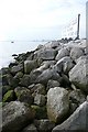
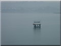
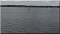
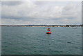
18 photos from this area
Area Information
Key information about the BH14 8EH including its size, population, and administrative classification.
- Area Type
- Postcode
- Area Size
- 95.0 hectares
- Population
- Not available
- Population Density
- Not available
House Prices in BH14 8EH
13
Properties
£3,982,222
Average Sold Price
£2,500,000
Lowest Price
£6,895,000
Highest Price
Showing 13 properties
| Address | Type | Beds | Baths | Last Sale Price | Last Sale Date | |
|---|---|---|---|---|---|---|
| 62 Pearce Avenue, Poole, BH14 8EH | Detached | 4 | 4 | £5,670,000 | Mar 2022 | |
| 40 Pearce Avenue, Poole, BH14 8EH | Detached | 5 | - | £4,835,000 | Jun 2021 | |
| 58 Pearce Avenue, Poole, BH14 8EH | Detached | 5 | 6 | £6,895,000 | Mar 2021 | |
| 46 Pearce Avenue, Poole, BH14 8EH | Detached | 4 | 3 | £3,100,000 | Jun 2019 | |
| 42 Pearce Avenue, Poole, BH14 8EH | Detached | 5 | - | £2,500,000 | Aug 2017 | |
| 38 Pearce Avenue, Poole, BH14 8EH | house | - | - | £4,200,000 | Nov 2014 | |
| 56 Pearce Avenue, Poole, BH14 8EH | Detached | 5 | - | £2,950,000 | Sep 2013 | |
| 60 Pearce Avenue, Poole, BH14 8EH | Detached | - | - | £2,950,000 | Sep 2006 | |
| 56A Pearce Avenue, Poole, BH14 8EH | Detached | 6 | 9 | £2,740,000 | Aug 2006 | |
| 54 Pearce Avenue, Poole, BH14 8EH | house | 4 | - | - | - |
Page 1 of 2
Energy Efficiency in BH14 8EH
Amenities
Schools
| Rank | School | Type | Entry gender | Ages |
|---|
Explore more schools in this area
Go to Schools tabDemographics
Household Size
One person
most common
Accommodation Type
Houses
most common
Tenure
52
majority
Ethnic Group
White
most common
Religion
N/A
most common
Household Composition
N/A
most common
Age
47
median
Adults (30-64 years)
most common
Household Deprivation
N/A
with no deprivation
NS-SEC
37
in Lower managerial occupations
Explore more demographic insights in this area
Go to Demographics tabPlanning
Planning Constraints
- Flood RiskPremium
- Ramsar Wetland SitesPremium
- Area of Outstanding Natural BeautyPremium
- Protected Nature ReservePremium
- Protected WoodlandPremium