Area Overview for BH14 0AA
Photos of BH14 0AA
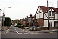

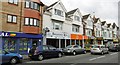
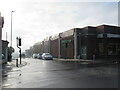
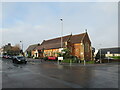
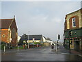

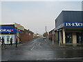
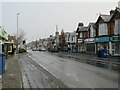
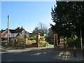
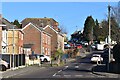
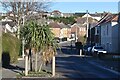
27 photos from this area
Area Information
Key information about the BH14 0AA including its size, population, and administrative classification.
- Area Type
- Postcode
- Area Size
- 1.0 hectares
- Population
- 1984
- Population Density
- 8072 people/km²
House Prices in BH14 0AA
30
Properties
£114,103
Average Sold Price
£30,616
Lowest Price
£200,000
Highest Price
Showing 30 properties
| Address | Type | Beds | Baths | Last Sale Price | Last Sale Date | |
|---|---|---|---|---|---|---|
| 422A Ashley Road, Poole, BH14 0AA | Flat | - | - | £125,000 | Oct 2025 | |
| 424A Ashley Road, Poole, BH14 0AA | Block of Flats | 4 | 2 | £65,000 | Apr 2021 | |
| 434A Ashley Road, Poole, BH14 0AA | Flat | - | - | £200,000 | May 2019 | |
| 432A Ashley Road, Poole, BH14 0AA | Terraced | - | - | £30,616 | Jan 2017 | |
| 406A Ashley Road, Poole, BH14 0AA | Flat | 1 | - | £90,000 | Feb 2010 | |
| 402A Ashley Road, Poole, BH14 0AA | Flat | - | - | £174,000 | Aug 2004 | |
| Flat 2, 414 Ashley Road, Poole, BH14 0AA | Flat | 2 | 1 | - | - | |
| Flat 1, 390 Ashley Road, Poole, BH14 0AA | Flat | 2 | 1 | - | - | |
| Flat 1, 440 Ashley Road, Poole, BH14 0AA | Flat | 1 | 1 | - | - | |
| First Floor Flat, 394 Ashley Road, Poole, BH14 0AA | Flat | 2 | 1 | - | - |
Page 1 of 3
Energy Efficiency in BH14 0AA
Amenities
Schools
| Rank | School | Type | Entry gender | Ages |
|---|
Explore more schools in this area
Go to Schools tabDemographics
Household Size
One person
most common
Accommodation Type
Houses
most common
Tenure
56
majority
Ethnic Group
White
most common
Religion
N/A
most common
Household Composition
N/A
most common
Age
47
median
Adults (30-64 years)
most common
Household Deprivation
N/A
with no deprivation
NS-SEC
31
in Lower managerial occupations
Explore more demographic insights in this area
Go to Demographics tabPlanning
Planning Constraints
- Flood RiskPremium
- Ramsar Wetland SitesPremium
- Area of Outstanding Natural BeautyPremium
- Protected Nature ReservePremium
- Protected WoodlandPremium