Area Overview for BH13 7YB
Photos of BH13 7YB

Area Information
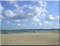
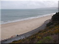
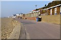
BH13 7YB is a small residential cluster in Poole, Dorset, part of the Canford Cliffs Ward. With a population of 1,525 and a density of 1,229 people per square kilometre, it is a compact, seaside community established on what was once Lord Wimborne’s Canford Estate. The area’s character is shaped by its history as a 19th-century residential development, with large south-facing plots originally targeted at wealthy buyers. Today, it remains a mix of owner-occupied flats and holiday homes, reflecting its evolution from a Victorian-era estate to a modern residential area. The proximity to the coast offers access to watersports like sailboarding, while nearby amenities include shops, ferry terminals, and rail stations. The community is defined by its proximity to both urban convenience and natural scenery, with cliffs, chines, and open heathland nearby. For those seeking a blend of coastal living and practical infrastructure, BH13 7YB offers a distinctive balance of residential tranquility and connectivity.
- Area Type
- Postcode
- Area Size
- Not available
- Population
- 1525
- Population Density
- 1229 people/km²
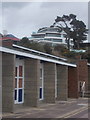
The property market in BH13 7YB is characterised by a high rate of home ownership (72%) and a predominance of flats. This reflects the area’s origins as a planned residential estate and its subsequent development into a more densely populated neighbourhood. Many of the original Victorian and Edwardian homes have been replaced by modern blocks of flats, creating a housing stock that is largely medium to high-rise. The compact size of the postcode area means that property choices are limited, with most options concentrated in the immediate vicinity. For buyers, this implies a market where flats are the norm, and the availability of larger homes is constrained. The area’s proximity to Poole and Bournemouth also means it is influenced by regional property trends, with holiday lets and second homes contributing to the local economy.
House Prices in BH13 7YB
No properties found in this postcode.
Energy Efficiency in BH13 7YB
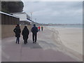
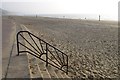
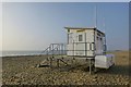
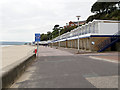
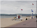
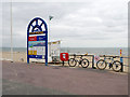
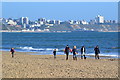
Living in BH13 7YB offers a mix of seaside leisure and urban convenience. The area is served by five retail outlets, including Tesco Shore, Tesco Canford, and Tesco Lilliput, providing everyday shopping needs. Ferries to Brownsea Island and Sandbanks open up access to coastal walks and watersports, while rail stations connect to Poole, Bournemouth, and beyond. The nearby Canford Cliffs and Sandbanks areas feature open heathland, cliffs, and historic sites like Holy Angels Church and the Martello Tower. The shallow waters of the harbour support sailboarding, a key recreational activity. For residents, daily life balances proximity to nature with the practicality of nearby amenities. The area’s compact size means most services are within walking or short driving distance, enhancing its appeal as a convenient, coastal community.
Amenities
Schools
| Rank | School | Type | Entry gender | Ages |
|---|
Explore more schools in this area
Go to Schools tabDemographics
The population of BH13 7YB has a median age of 47, with the majority of residents aged between 30 and 64. This suggests a community of established professionals and families, rather than a younger or elderly demographic. Home ownership is high, with 72% of properties occupied by their owners, indicating a stable housing market. The predominant accommodation type is flats, a legacy of the area’s 19th-century development and more recent higher-density construction. The predominant ethnic group is White, reflecting the area’s historical roots and limited demographic diversity. The high population density—1,229 people per square kilometre—means the area is tightly packed, with limited space for expansion. While the data does not specify deprivation levels, the combination of high home ownership and a mature age profile suggests a community with relatively stable economic conditions.
Household Size
Accommodation Type
Tenure
Ethnic Group
Religion
Household Composition
Age
Household Deprivation
NS-SEC
Explore more demographic insights in this area
Go to Demographics tabPlanning
Planning Constraints
- Flood RiskPremium
- Ramsar Wetland SitesPremium
- Area of Outstanding Natural BeautyPremium
- Protected Nature ReservePremium
- Protected WoodlandPremium