Area Overview for BH13 7NG
Photos of BH13 7NG
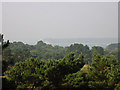
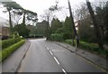
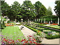

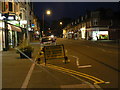


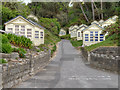
100 photos from this area
Area Information
Key information about the BH13 7NG including its size, population, and administrative classification.
- Area Type
- Postcode
- Area Size
- 1.5 hectares
- Population
- 1780
- Population Density
- 1152 people/km²
House Prices in BH13 7NG
8
Properties
£1,298,600
Average Sold Price
£560,000
Lowest Price
£2,500,000
Highest Price
Showing 8 properties
| Address | Type | Beds | Baths | Last Sale Price | Last Sale Date | |
|---|---|---|---|---|---|---|
| The Lookout, 2C Nairn Road, Poole, BH13 7NG | Retail | 3 | 2 | £1,150,000 | Feb 2022 | |
| 4A Nairn Road, Poole, BH13 7NG | Detached | 4 | 3 | £1,583,000 | Oct 2020 | |
| 4 Nairn Road, Poole, BH13 7NG | Land | - | - | £2,500,000 | Mar 2016 | |
| 2A Nairn Road, Poole, BH13 7NG | Bungalow | 4 | 3 | £700,000 | May 2014 | |
| 2D Nairn Road, Poole, BH13 7NG | Detached | - | - | £560,000 | Aug 2000 | |
| 6A Nairn Road, Poole, BH13 7NG | Detached | - | - | - | - | |
| Hamlet House, 2B Nairn Road, Poole, BH13 7NG | Bungalow | 3 | - | - | - | |
| Dreams, 6 Nairn Road, Poole, BH13 7NG | Detached | - | - | - | - |
Energy Efficiency in BH13 7NG
Amenities
Schools
| Rank | School | Type | Entry gender | Ages |
|---|
Explore more schools in this area
Go to Schools tabDemographics
Household Size
Two person
most common
Accommodation Type
Flats
most common
Tenure
84
majority
Ethnic Group
White
most common
Religion
N/A
most common
Household Composition
N/A
most common
Age
47
median
Elderly (65+ years)
most common
Household Deprivation
N/A
with no deprivation
NS-SEC
54
in Lower managerial occupations
Explore more demographic insights in this area
Go to Demographics tabPlanning
Planning Constraints
- Flood RiskPremium
- Ramsar Wetland SitesPremium
- Area of Outstanding Natural BeautyPremium
- Protected Nature ReservePremium
- Protected WoodlandPremium