Area Overview for BH13 7LT
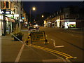
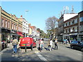
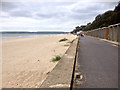
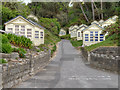
Photos of BH13 7LT


Area Information
Living in BH13 7LT means being part of a small, tightly knit residential cluster in Poole, Dorset. The area, known as Canford Cliffs Ward, sits on land once owned by Lord Wimborne, transformed into a seaside community by Victorian developers in 1886. With a population of 1,525 and a density of 1,229 people per square kilometre, it is a compact, well-defined postcode area. The character of BH13 7LT is shaped by its history as a planned estate, with large, south-facing plots originally designed for affluent buyers. While many of the original Victorian and Edwardian homes have been replaced by modern blocks of flats, the area retains its coastal charm. Residents enjoy proximity to the sea, with watersports like sail boarding thriving in the shallow waters. The ward is split between Bournemouth West and Poole constituencies, and its mix of permanent homes, holiday flats, and second homes reflects its dual role as a residential and leisure destination. Daily life here is defined by a quiet, seaside rhythm, with amenities and transport links ensuring practicality for residents.
- Area Type
- Postcode
- Area Size
- Not available
- Population
- 1525
- Population Density
- 1229 people/km²
The property market in BH13 7LT is dominated by flats, with 72% of homes owner-occupied. This contrasts with the area’s original development, which featured large, detached residences. Over time, many of these historic properties have been replaced by modern blocks of flats, reflecting a shift toward higher-density housing. The market is primarily driven by residential buyers, with a notable presence of second homes and holiday flats, as the area remains a popular seaside destination. For prospective buyers, this means a mix of established, well-maintained flats and a limited number of larger properties. The small size of the postcode area means the immediate surroundings offer few alternative housing options, making BH13 7LT a niche market. The high home ownership rate suggests a stable, long-term resident base, though the prevalence of rental properties indicates some turnover. Buyers should consider the area’s focus on leisure and coastal living when evaluating property value and suitability.
House Prices in BH13 7LT
No properties found in this postcode.
Energy Efficiency in BH13 7LT
Residents of BH13 7LT have access to a range of amenities within practical reach. Five retail outlets, including Tesco Canford, Tesco Shore, and Tesco Lilliput, provide everyday shopping needs. Rail stations like Branksome and Poole connect to broader transport networks, while ferry terminals at Sandbanks and Shell Bay offer coastal excursions. Bournemouth Airport is a short distance away, facilitating travel. The area’s proximity to the sea supports a watersports culture, with sail boarding thriving in the shallow waters. Historic landmarks such as Holy Angels Church and the Martello Tower add to the local character. The ward’s mix of retail, transport, and leisure options creates a convenient lifestyle, blending seaside living with practical amenities. The presence of multiple shops, transport hubs, and recreational opportunities ensures daily life is both accessible and varied for residents.
Amenities
Schools
| Rank | School | Type | Entry gender | Ages |
|---|
Explore more schools in this area
Go to Schools tabDemographics
The population of BH13 7LT is predominantly adults aged 30–64, with a median age of 47. This suggests a community of established professionals and families, many of whom own their homes—72% of properties are owner-occupied. The accommodation type is largely flats, reflecting a shift from the area’s original large detached homes to higher-density living. The predominant ethnic group is White, though specific diversity statistics are not provided. The high population density of 1,229 people per square kilometre indicates a compact, closely packed residential cluster. While no data on deprivation or income levels is available, the high home ownership rate and age profile suggest a stable, middle-income demographic. The presence of 5 retail amenities, including multiple Tesco stores, and proximity to rail and ferry services support daily life for this age group. The community’s character is shaped by its history as a planned estate, with a legacy of leisure-focused development.
Household Size
Accommodation Type
Tenure
Ethnic Group
Religion
Household Composition
Age
Household Deprivation
NS-SEC
Explore more demographic insights in this area
Go to Demographics tabPlanning
Planning Constraints
- Flood RiskPremium
- Ramsar Wetland SitesPremium
- Area of Outstanding Natural BeautyPremium
- Protected Nature ReservePremium
- Protected WoodlandPremium