Area Overview for BH13 7JQ
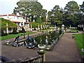
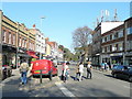
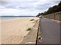
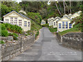
Photos of BH13 7JQ


Area Information
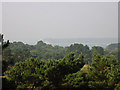
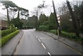
BH13 7JQ represents a specific residential cluster within the wider Canford Cliffs ward of Poole, Dorset. This area spans just over three thousand square metres of densely packed living space, creating an intimate neighbourhood feel. With a population of 1,780 people, it functions as a quiet, exclusive pocket of community life within the expansive South West English coastline. The location is defined by its origins as part of Lord Wimborne's historic estate, yet it has evolved into a modern affine residential setting. Residents enjoy the benefits of established infrastructure while remaining close to the rugged, wild coastline that once served as a smuggler's haven. Daily life here is characterised by a blend of seaside leisure and settled domesticity. The area sits between the Bournemouth West and Poole constituencies, reflecting its strategic position within the borough. Living in this postcode means you are situated in a community that prioritises large, south-facing plots originally intended for daytime use, though recent decades have seen a shift towards higher-density construction. The modern settlement dates back to 1886, when developers transformed open heathland into a structured village with estate roads and utilities laid out in advance. Today, the cluster retains its distinct character as a sheltered harbour environment, known for its suitability for watersports like sail boarding due to shallow waters. The architecture has shifted from Victorian and Edwardian homes to contemporary blocks of flats, mirroring the changing demands of the market. This small area offers a peaceful retreat from the busier parts of the Dorset coast while maintaining easy access to local services and transport links.
- Area Type
- Postcode
- Area Size
- 3043 m²
- Population
- 1780
- Population Density
- 1152 people/km²
The housing market within BH13 7JQ is heavily skewed towards ownership, with 84% of homes held by owners rather than landlords. This statistic distinguishes the area from typical holiday let zones where rental turnover might be higher. The predominant accommodation type consists of flats, reflecting the shift in developer focus over recent decades. Many larger Victorian and Edwardian properties have been replaced by modern blocks to meet contemporary demands for efficient, multi-bedroom living spaces. This transition from individual plots to dense flats alters the visual character of the streets, yet the underlying plot value remains high due to the desirable location. For buyers looking at this small area and its immediate surroundings, the market presents a chance to enter a neighbourhood with established stability. The shift towards higher-density residential development means that opportunities to purchase heritage-listed structures are rarer, though modern blocks offer new-build options. The specific layout of BH13 7JQ, covering only 3,043 square metres, suggests limited space for large speculative developments, preserving much of the original planning intent. This constraint protects the environment from commercial or industrial encroachment, as managed historically by the Land Society. Consequently, the property market here retains a certain exclusivity. Prospective buyers can expect a stock defined by quality over quantity, with values supported by the area's reputation as an affluent seaside community suitable for both permanent residence and leisure use.
House Prices in BH13 7JQ
Showing 7 properties
| Address | Type | Beds | Baths | Last Sale Price | Last Sale Date | |
|---|---|---|---|---|---|---|
| 2A Macandrew Road, Poole, BH13 7JQ | Detached | 5 | 4 | £1,050,000 | Dec 2019 | |
| 4 Macandrew Road, Poole, BH13 7JQ | house | - | - | £1,220,000 | Nov 2018 | |
| 3 Macandrew Road, Poole, BH13 7JQ | house | - | - | £1,000,000 | Jan 2011 | |
| 1 Macandrew Road, Poole, BH13 7JQ | house | - | - | £925,000 | Dec 2009 | |
| 2 Macandrew Road, Poole, BH13 7JQ | house | 5 | - | £960,000 | Oct 2008 | |
| Land At 4, Macandrew Road, Poole, BH13 7JQ | undefined | - | - | - | - | |
| 4A Macandrew Road, Poole, BH13 7JQ | Detached | - | - | - | - |
Energy Efficiency in BH13 7JQ
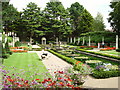
Residents of BH13 7JQ benefit from a well-developed network of amenities within a short walk or drive. Retail options are anchored by three major supermarket branches: Tesco Canford, Tesco Shore, and Tesco Lilliput. These locations ensure that daily grocery shopping and household essentials are readily available without the need for long journeys. For those seeking public transport, five railway stations are nearby, including Branksome, Parkstone, and Poole Railway Stations, offering extensive links to the wider region. Additionally, the area has access to five ferry terminals at Brownsea Island, Sandbanks, and Shell Bay, catering to leisure trips and local island hopping. The leisure culture is deeply rooted in the landscape, with pleasure gardens, chines, and cliff-top areas offering open spaces for recreation. Historic landmarks such as Holy Angels Church, built in 1873, serve as community focal points. The Martello Tower, originally constructed to monitor the coast, stands as a reminder of the area's maritime history, although parts of the cliffs have eroded over time. Sail boarding is a significant activity due to the shallow harbour waters, providing a unique local pastime. The Norfolk Lodge Hotel on Haven Road preserves some of the original Victorian architecture, adding to the architectural interest of the parade of services in the area. Living here means having historic charm and modern convenience in equal measure, creating a balanced lifestyle for families and retirees alike.
Amenities
Schools
| Rank | School | Type | Entry gender | Ages |
|---|
Explore more schools in this area
Go to Schools tabDemographics
The community residing in BH13 7JQ is primarily an older demographic group. Data indicates a median age of 47 years, with the elderly population aged 65 and over forming the most common age range. This suggests the neighbourhood has settled into a phase where many original estate plots are occupied by long-term residents. Home ownership is highly prevalent, with 84% of properties owned outright or with mortgage. This high rate suggests stability and a lack of significant tenant turnover within the immediate vicinity. The accommodation type in this postcode is flats, a development from its Victorian heyday when fewer dwellings served as permanent homes compared to holiday rentals. The predominant ethnic group is White, consistent with the broader demographics of the Poole and Bournemouth coastal regions. Despite being a residential seaside community, the area does not show signs of the transient lifestyle expected of many holiday destinations, as evidenced by the high ownership figures. The population density stands at 1,152 people per square kilometre, indicating a compact living environment where neighbours are close by. This density supports a strong sense of local identity without the congestion found in larger urban centres. The area's history as a planned estate contributes to a cohesive social fabric, where residents share a common understanding of the landscape and its constraints.
Household Size
Accommodation Type
Tenure
Ethnic Group
Religion
Household Composition
Age
Household Deprivation
NS-SEC
Explore more demographic insights in this area
Go to Demographics tabPlanning
Planning Constraints
- Flood RiskPremium
- Ramsar Wetland SitesPremium
- Area of Outstanding Natural BeautyPremium
- Protected Nature ReservePremium
- Protected WoodlandPremium