Area Overview for BH13 6ZP
Photos of BH13 6ZP
Area Information
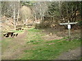
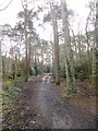
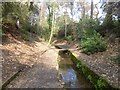
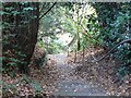
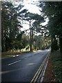
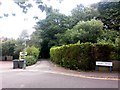
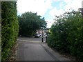
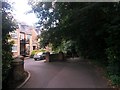
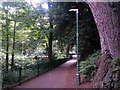
Living in BH13 6ZP means being part of a small, tightly knit residential cluster in Canford Cliffs, Poole, Dorset. With a population of 1,722, this area is defined by its seaside character and historical roots as part of the Canford Estate, originally developed in 1886. The community is predominantly elderly, with a median age of 70, reflecting a demographic shaped by long-term residency and a focus on quiet, established living. The area’s proximity to Bournemouth and Poole offers easy access to coastal amenities, while its origins as a planned estate ensure a cohesive, low-density layout. Residents benefit from a mix of modern and historic architecture, with many properties set in large, south-facing plots. The area’s watersports facilities, including sail boarding on shallow harbour waters, add to its appeal as a leisure destination. Despite its small size, BH13 6ZP combines residential tranquility with practical connectivity, making it a distinctive choice for those seeking a coastal lifestyle with a strong sense of community.
- Area Type
- Postcode
- Area Size
- Not available
- Population
- 1722
- Population Density
- 4190 people/km²
The property market in BH13 6ZP is characterised by a high rate of home ownership (77%) and a prevalence of flats. This suggests a community where many residents own their homes, possibly reflecting the area’s historical development as a planned estate with a focus on residential living. The accommodation type, primarily flats, indicates a mix of older, purpose-built properties and newer developments, though the data does not specify the age distribution of these homes. The shift towards higher-density housing in recent decades has seen some Victorian and Edwardian properties replaced by modern blocks of flats, altering the area’s architectural landscape. For buyers, this means a market dominated by owner-occupied flats in a small, established area, with limited scope for rental investment. The proximity to Bournemouth and Poole may also influence property values, though specific trends are not provided.
House Prices in BH13 6ZP
No properties found in this postcode.
Energy Efficiency in BH13 6ZP
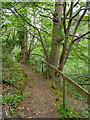
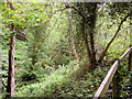
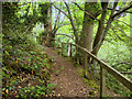
Residents of BH13 6ZP have access to a range of amenities within practical reach, including retail outlets such as M&S Westbourne, Cook Bournemouth, and Tesco Poole. These shops provide everyday convenience, while nearby railway stations, ferries, and airports enhance mobility. The area’s watersports facilities, particularly sail boarding on the shallow harbour, highlight its recreational appeal. Historic landmarks like Holy Angels Church and the Martello Tower add cultural depth, though the latter has been lost to erosion. The community’s character is shaped by its seaside setting, with open spaces, chines, and cliff-top areas offering opportunities for walking and relaxation. The mix of retail, transport, and leisure options supports a lifestyle that balances coastal living with practicality, making BH13 6ZP appealing to those who value both tranquility and accessibility.
Amenities
Schools
| Rank | School | Type | Entry gender | Ages |
|---|
Explore more schools in this area
Go to Schools tabDemographics
The demographic profile of BH13 6ZP is shaped by its elderly population, with 70% of residents aged 65 or older. This age group dominates, reflecting a community where long-term residency and retirement are common. Home ownership is high, at 77%, with flats being the primary accommodation type. This suggests a mix of owner-occupied properties and possibly some rental units, though the data does not specify the latter. The predominant ethnic group is White, indicating a homogenous demographic. The high home ownership rate and age profile suggest a stable, low-turnover community with limited demand for short-term rentals or student housing. The absence of specific data on deprivation means the area’s quality of life is likely supported by its low crime rates and access to amenities, though further analysis would be needed to confirm this.
Household Size
Accommodation Type
Tenure
Ethnic Group
Religion
Household Composition
Age
Household Deprivation
NS-SEC
Explore more demographic insights in this area
Go to Demographics tabPlanning
Planning Constraints
- Flood RiskPremium
- Ramsar Wetland SitesPremium
- Area of Outstanding Natural BeautyPremium
- Protected Nature ReservePremium
- Protected WoodlandPremium