Area Overview for BH13 6LE
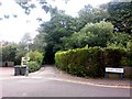
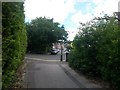
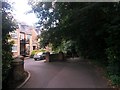
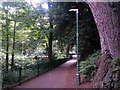
Photos of BH13 6LE
Area Information
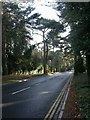
Canford Cliffs represents a distinctive residential seaside community in Poole, Dorset, where living in BH13 6LE offers a blend of established heritage and coastal character. This specific postcode covers a small residential cluster spanning just 1.3 hectares, housing a population of 1679 people. The area was originally part of Lord Wimborne's vast Canford Estate before transforming into a modern settlement in 1886, established by Bournemouth businessmen on what was previously open heathland. While the rugged coastline once served smugglers, today it functions primarily as an affluent residential zone defined by large south-facing plots designed for wealthy buyers. The village evolved rapidly in the late nineteenth century, developing shops and hotels along Haven Road within twenty years of its initial layout. Residents today experience a community that has shifted significantly since its Victorian heyday, with many historic properties replaced by modern developments. The area remains characterised by its leisure focus, particularly its reputation for watersports like sail boarding due to the shallow harbour waters. Recent decades have seen higher-density development replace some larger Victorian and Edwardian homes, yet the core identity remains that of a planned residential haven. Those buying homes in BH13 6LE enter an environment shaped by the Land Society, formed in 1925 to preserve original covenants preventing industrial intrusion. This historical context ensures a carefully regulated environment, maintaining the area's status as a quiet, residential destination rather than a commercial hub.
- Area Type
- Postcode
- Area Size
- 1.3 hectares
- Population
- Not available
- Population Density
- Not available
The property market in BH13 6LE is distinctly characterised by a strong owner-occupied sector. With 82% of residents owning their homes, this indicates a stable housing stock where most dwellings are primarily residences rather than investment properties or short-term lets. This high ownership figure contrasts with many modern coastal towns where holiday flats dominate the market, suggesting that today's occupants in BH13 6LE value long-term security over seasonal usage. The accommodation type is overwhelmingly houses, reflecting the area's history as part of the Canford Estate, which was laid out individually rather than as blocks of flats. While some modern blocks have replaced older Victorian and Edwardian properties, the fundamental nature of the housing remains that of detached or semi-detached family homes. For buyers considering homes in this small cluster, the high ownership rate means fewer tenants and a quieter street life, as owners are more likely to maintain their properties and neighbourly standards. The market in BH13 6LE operates on the principle of permanent residence rather than the transient leisure economy seen elsewhere in the region. Original properties from the Victorian era remain a feature of the landscape, though many have been modernised or replaced by contemporary blocks to meet current living needs. The presence of the Land Society, formed in 1925 to manage the estate, has historically protected the area from commercial development, ensuring that the housing remains focused on residential needs. This structural integrity means that the property market here is less volatile than areas driven purely by holiday rental demand, offering buyers a degree of security regarding future planning constraints and property types.
House Prices in BH13 6LE
Showing 7 properties
| Address | Type | Beds | Baths | Last Sale Price | Last Sale Date | |
|---|---|---|---|---|---|---|
| 12 Buccleuch Road, Poole, BH13 6LE | Bungalow | 3 | 4 | £2,800,000 | May 2025 | |
| 14 Buccleuch Road, Poole, BH13 6LE | house | - | - | £2,150,000 | May 2024 | |
| 6 Buccleuch Road, Poole, BH13 6LE | Detached | 4 | - | £327,000 | Jun 1997 | |
| 2 Buccleuch Road, Poole, BH13 6LE | Detached | - | - | - | - | |
| 10 Buccleuch Road, Poole, BH13 6LE | house | - | - | - | - | |
| 4 Buccleuch Road, Poole, BH13 6LE | house | - | - | - | - | |
| 4A Buccleuch Road, Poole, BH13 6LE | Detached | - | - | - | - |
Energy Efficiency in BH13 6LE
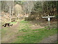
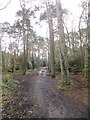
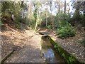
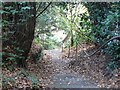
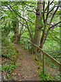
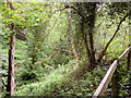
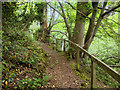
Living in BH13 6LE offers convenient access to a range of retail and leisure amenities within practical reach. For everyday shopping, you have five key retail options nearby, including Tesco Canford, M&S Westbourne, and Cook Bournemouth, ensuring that groceries and household essentials are readily available without a long journey. Transport links are equally extensive, with five railway stations including Branksome and Parkstone serving the area, alongside five ferry terminals at Brownsea Island, Sandbanks, and Shell Bay for coastal travel. Two airports, Bournemouth Airport and Bournemouth International Airport, provide air connectivity, making this a well-connected location despite its residential nature. The area's character is enriched by historic landmarks and open spaces that define its leisure culture. Holy Angels Church, built in 1873, serves as a community focal point, while the Martello Tower stands as a reminder of the area's maritime defensive history. The landscape features chines, cliffs, and cliff-top areas, offering scenic walks and play for residents. The shallow harbour waters have earned the area a reputation as one of the best places in the country for sail boarding, supporting a local watersports industry and recreational activity. Historic houses like Carkeel, now the Norfolk Lodge Hotel, add to the architectural interest along Haven Road. This blend of natural beauty, historical sites, and modern transport infrastructure creates a lifestyle where you can enjoy coastal pursuits while remaining well-serviced by commercial and transport networks.
Amenities
Schools
| Rank | School | Type | Entry gender | Ages |
|---|
Explore more schools in this area
Go to Schools tabDemographics
The demographic profile of BH13 6LE reflects its status as a mature settlement with a clear residential focus. The median age in the area is 47 years, indicating a population skewed towards adults and older adults rather than a young family demographic. The most common age range is the elderly group aged 65 and over, suggesting this is a neighbourhood preferred by those seeking a quieter retirement or a permanent home away from the pace of city life. This age structure aligns with the high level of home ownership, which stands at 82% within the postcode. Such a high ownership rate typically indicates stability and long-term residents rather than a fluctuating rental market. The accommodation type data shows a predominance of houses, consistent with the ward's origins as a planned estate with large individual plots. Ethnically, the predominant group is White, which reflects the historical development of the area and the preferences of the buyers who established the original village. With a population density of 131416 people per square kilometre, the area feels residential without being overcrowded, despite its small physical footprint of just under 2 hectares. The high proportion of elderly residents combined with substantial home ownership creates a community that is likely stable, with many families having purchased properties decades ago. This demographic makeup means schools near BH13 6LE may serve a mixed age cohort, with a significant portion of local households potentially having grown children who have moved away.
Household Size
Accommodation Type
Tenure
Ethnic Group
Religion
Household Composition
Age
Household Deprivation
NS-SEC
Explore more demographic insights in this area
Go to Demographics tabPlanning
Planning Constraints
- Flood RiskPremium
- Ramsar Wetland SitesPremium
- Area of Outstanding Natural BeautyPremium
- Protected Nature ReservePremium
- Protected WoodlandPremium