Area Overview for BH13 6EG
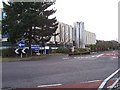
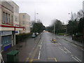
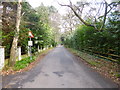
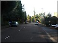
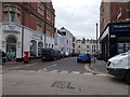
Photos of BH13 6EG


Area Information
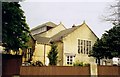
Living in BH13 6EG, part of the Canford Cliffs Ward in Poole, Dorset, means being part of a small, densely populated residential cluster with a distinct seaside character. The area, established on the former Canford Estate in 1886, blends Victorian-era development with modern housing. With 1,837 residents in a compact footprint, the community is defined by its proximity to the coast, open heathland, and a mix of historic and contemporary architecture. The ward is split between Bournemouth West and Poole constituencies, reflecting its geographical position. Daily life here is shaped by coastal access, watersports like sail boarding, and a network of nearby amenities. While the area has evolved from its original affluent residential vision, recent decades have seen a shift toward higher-density living, with many older properties replaced by flats. Despite this, the area retains a quiet, residential feel, with a focus on leisure and proximity to natural landscapes.
- Area Type
- Postcode
- Area Size
- Not available
- Population
- 1837
- Population Density
- 1642 people/km²
BH13 6EG is characterised by a high proportion of flats, with 69% of homes owned by residents. This suggests a mix of owner-occupied and rental properties, though the data does not specify the split. The area’s housing stock reflects its historical development: originally designed for wealthy buyers with large plots, it has shifted toward higher-density living in recent decades. Modern blocks of flats now sit alongside surviving Victorian and Edwardian properties, creating a varied landscape. For buyers, this means a limited number of available properties in a small area, with a focus on flats rather than detached homes. The compact nature of the postcode and its proximity to coastal amenities may appeal to those seeking a blend of residential convenience and seaside access, though the market is likely competitive given the area’s popularity.
House Prices in BH13 6EG
No properties found in this postcode.
Energy Efficiency in BH13 6EG
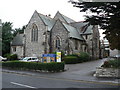
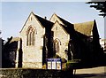
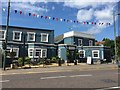
The lifestyle in BH13 6EG is shaped by its coastal location and proximity to amenities. Nearby shops include Tesco Poole, Lidl Parkstone, and M&S Westbourne, catering to daily needs. The area’s rail links and ferry services provide easy access to the coast, where watersports like sail boarding thrive. Residents can also reach Bournemouth Airport and Poole Quay for travel or leisure. The ward’s historic character, with landmarks like Holy Angels Church and the Martello Tower, adds cultural depth to daily life. While the area’s compact size means amenities are concentrated, the mix of retail, transport, and coastal access supports a convenient, active lifestyle.
Amenities
Schools
The only school explicitly listed near BH13 6EG is Victoria Education Centre, a special school. No other schools are mentioned in the data, meaning families with children may need to look beyond the immediate area for primary or secondary education. The absence of mainstream schools suggests that the ward’s demographic may skew toward older residents or those with children attending institutions elsewhere. For families prioritising proximity to schools, this could be a limitation, though the area’s coastal location and other amenities may offset this drawback.
| Rank | School | Type | Entry gender | Ages |
|---|
Explore more schools in this area
Go to Schools tabDemographics
The population of BH13 6EG has a median age of 47, with the majority of residents falling in the 30-64 age range. This suggests a community skewed toward adults, likely reflecting the area’s history as a family-oriented seaside settlement. Home ownership stands at 69%, indicating a stable residential base, though the predominant accommodation type is flats, which may imply a higher proportion of rental properties. The White ethnic group is the largest demographic, though no further diversity data is provided. The age profile and ownership figures suggest a mature, settled population, with a focus on long-term residency. The area’s density—1,642 people per square kilometre—highlights its compact nature, which may influence local services and community dynamics.
Household Size
Accommodation Type
Tenure
Ethnic Group
Religion
Household Composition
Age
Household Deprivation
NS-SEC
Explore more demographic insights in this area
Go to Demographics tabPlanning
Planning Constraints
- Flood RiskPremium
- Ramsar Wetland SitesPremium
- Area of Outstanding Natural BeautyPremium
- Protected Nature ReservePremium
- Protected WoodlandPremium