Area Overview for BH13 6BA
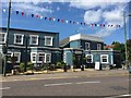
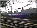
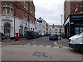
Photos of BH13 6BA
Area Information
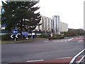
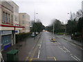
Canford Cliffs, covered by the BH13 6BA postcode, is a residential seaside community with a clear historical identity. This ward sits within the larger Poole borough and stretches along the coastline between Bournemouth and Poole constituencies. The area covers approximately 7,758 square metres of land and supports a resident population of 1,722 people. Originally part of Lord Wimborne's estate, the settlement transformed from heathland into a planned village starting in 1886. Developers laid out infrastructure and utilities before selling plots, creating a structured layout that defined life here for over a century. While Victorian grandeur once characterised the estate, recent decades have seen a significant shift in character. Many large Edwardian properties have been replaced by modern blocks of flats to accommodate higher density. The modern settlement functions as an affluent residential zone where the original open heathland has been largely superseded by contemporary housing and leisure facilities. You live in a location that balances seaside history with modern convenience, situated within easy reach of major transport hubs and maritime leisure activities.
- Area Type
- Postcode
- Area Size
- 7758 m²
- Population
- 1722
- Population Density
- 4190 people/km²
The housing market in BH13 6BA is characterised by a high concentration of owner-occupiers who own their homes outright or are paying a mortgage. With 77% of residents owning their properties, this small postcode area functions largely as an established residential zone rather than a rapid turnover rental sector. Flats dominate the current architecture of the area, having largely replaced the larger Victorian and Edwardian houses that defined the original Canford Cliffs estate. This shift reflects a broader trend where modern high-density blocks have supplanted many of the original large south-facing plots. For buyers, this environment offers specific types of dwellings suited to an older demographic and investors looking for holiday lets. The local economy relies heavily on residential property values and holiday lettings, creating a dynamic where second homes and holiday flats remain significant forces. You will find a stock of properties designed for leisure, with many units catering to seasonal visitors even as permanent residents maintain the core community structure.
House Prices in BH13 6BA
Showing 28 properties
| Address | Type | Beds | Baths | Last Sale Price | Last Sale Date | |
|---|---|---|---|---|---|---|
| 6, Conifers, 1 The Avenue, Poole, BH13 6BA | Flat | 2 | 1 | - | - | |
| 18, Conifers, 1 The Avenue, Poole, BH13 6BA | Flat | 2 | 1 | - | - | |
| 16, Conifers, 1 The Avenue, Poole, BH13 6BA | Flat | 2 | 1 | - | - | |
| 24, Conifers, 1 The Avenue, Poole, BH13 6BA | Flat | 2 | 2 | - | - | |
| 21, Conifers, 1 The Avenue, Poole, BH13 6BA | Flat | - | - | - | - | |
| 22, Conifers, 1 The Avenue, Poole, BH13 6BA | Flat | - | - | - | - | |
| 3, Conifers, 1 The Avenue, Poole, BH13 6BA | Flat | - | - | - | - | |
| 15, Conifers, 1 The Avenue, Poole, BH13 6BA | Flat | - | - | - | - | |
| 10, Conifers, 1 The Avenue, Poole, BH13 6BA | Flat | - | - | - | - | |
| 9, Conifers, 1 The Avenue, Poole, BH13 6BA | Flat | - | - | - | - |
Energy Efficiency in BH13 6BA
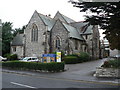
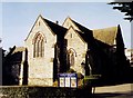
Daily life in BH13 6BA offers convenient access to a range of retail and leisure facilities just outside the residential cluster. For your weekly shopping needs, major supermarkets such as M&S Westbourne SF, Cook Bournemouth, and Iceland Westborne are located within practical reach. Public transport links are extensive, with five railway stations nearby including Branksome, Parkstone, and Bournemouth stations. If you prefer maritime travel, five ferry terminals serve the area, including the Brownsea Island Ferry Landing and Sandbanks Ferry Terminal. Aviation is also accessible with two airports, Bournemouth and Bournemouth International, within easy reach. The local character includes historic landmarks like Holy Angels Church and the Norfolk Lodge Hotel, formerly known as Carkeel. Pleasure gardens, chines, and cliff-top areas provide open spaces for residents to enjoy. You will also find watersports facilities that support sail boarding, a local speciality given the shallow harbour waters. These amenities create a community where residents can access work, leisure, and transport options without relying heavily on long-distance travel.
Amenities
Schools
| Rank | School | Type | Entry gender | Ages |
|---|
Explore more schools in this area
Go to Schools tabDemographics
People living in BH13 6BA form a mature community centred around older age groups. The median age for residents is 70 years, and the most common age bracket comprises individuals aged 65 and over. This profile suggests an area dominated by retirees and established long-term residents rather than families with young children shopping in nearby parks. Home ownership stands at a high level of 77%, indicating that the vast majority of households own their properties outright or through mortgage. This stability contrasts with areas that rely heavily on the rental market or student demographics. The local population remains predominantly White, reflecting a traditional homogeneous demographic structure common in historic Dorset coastal settlements. Flats form the primary type of accommodation in the BH13 6BA postcode area, replacing the sprawling single-family homes of the past. These figures describe a settled, older community where residents value stability and proximity to the coast over the anonymity of high-density urban living.
Household Size
Accommodation Type
Tenure
Ethnic Group
Religion
Household Composition
Age
Household Deprivation
NS-SEC
Explore more demographic insights in this area
Go to Demographics tabPlanning
Planning Constraints
- Flood RiskPremium
- Ramsar Wetland SitesPremium
- Area of Outstanding Natural BeautyPremium
- Protected Nature ReservePremium
- Protected WoodlandPremium