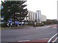
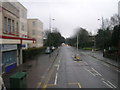
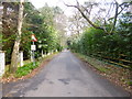
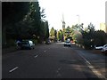
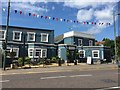
Area Overview for BH13 6AF
Photos of BH13 6AF
Area Information
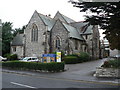
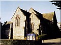
Living in BH13 6AF within Canford Cliffs Ward offers a distinct residential experience characterised by a specific historical legacy. This postcode covers a small residential cluster spanning 4,437 square metres. The area is part of a seaside community established on Lord Wimborne's original Canford Estate, where modern development began in 1886. Developers laid out infrastructure and utilities before selling plots to buyers travelling by special train from London. Today, the vicinity remains defined by its origins as an affluent residential destination created on what was once open heathland. A significant portion of the population now occupies flats, reflecting a shift from the Victorian and Edwardian homes that originally characterised the shore road locations. The modern settlement includes notable landmarks such as the historic Holy Angels Church, built in 1873 to serve the expanding neighbourhood. While the original Martello Tower was lost to cliff erosion, the area retains its connection to the rugged coastline that was once a haven for smugglers. With a population of 1,722 residents, this specific postcode represents a tightly knit pocket within the larger Poole district. You are buying into a space where the legacy of early nineteenth-century estate planning still influences the layout of streets and properties today.
- Area Type
- Postcode
- Area Size
- 4437 m²
- Population
- 1722
- Population Density
- 388112 people/km²
The property market in BH13 6AF is defined by a specific mix of housing stock and ownership types. Approximately 77 percent of residents own their homes, creating a steady environment for those purchasing older properties or flats within the cluster. The data confirms that flats are the primary category of accommodation available in this specific postcode, a departure from the large south-facing plots originally intended for wealthy Victorian buyers. Recent decades have seen a significant shift where many larger properties were replaced by modern blocks to meet housing demand. This transition means you will find fewer traditional detached villas and more purpose-built residential units. The economy remains driven largely by residential property and holiday lettings, with a significant number of second homes influencing the local market dynamics. Investors and holidaymakers contribute to the rental sector, although the overwhelming majority of households remain owner-occupied. When searching for homes in BH13 6AF, you are looking at a concentrated area where flat living is the norm. This contrasts with the surrounding wider ward, making this specific cluster a distinct option for buyers preferring a high-density urban feel within a coastal setting.
House Prices in BH13 6AF
Showing 16 properties
| Address | Type | Beds | Baths | Last Sale Price | Last Sale Date | |
|---|---|---|---|---|---|---|
| 3, The Squirrels, 24A The Avenue, Poole, BH13 6AF | Flat | 3 | 2 | - | - | |
| 16, The Squirrels, 24A The Avenue, Poole, BH13 6AF | Flat | 3 | 2 | - | - | |
| 7, The Squirrels, 24A The Avenue, Poole, BH13 6AF | Flat | 3 | - | - | - | |
| 11, The Squirrels, 24A The Avenue, Poole, BH13 6AF | Flat | - | - | - | - | |
| 9, The Squirrels, 24A The Avenue, Poole, BH13 6AF | Flat | - | - | - | - | |
| 8, The Squirrels, 24A The Avenue, Poole, BH13 6AF | Flat | - | - | - | - | |
| 10, The Squirrels, 24A The Avenue, Poole, BH13 6AF | Flat | - | - | - | - | |
| 4, The Squirrels, 24A The Avenue, Poole, BH13 6AF | Flat | - | - | - | - | |
| 5, The Squirrels, 24A The Avenue, Poole, BH13 6AF | Flat | - | - | - | - | |
| 17, The Squirrels, 24A The Avenue, Poole, BH13 6AF | Flat | - | - | - | - |
Energy Efficiency in BH13 6AF
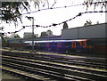
Residents of BH13 6AF have practical access to a defined range of amenities within a short walking distance. Your daily shopping routine can be managed at local outlets such as M&S Westbourne SF, Cook Bournemouth, and Iceland Westborne. These five major retail providers sit just a minute away by car and about a three-minute walk for quick errands. Getting around Britain is straightforward, with five railway stations serving the immediate neighbourhood including Branksome Railway Station, Parkstone Railway Station, and Bournemouth Railway Station. For coastal leisure, five ferry terminals offer regular departures from Brownsea Island Ferry Landing, Sandbanks Ferry Terminal, and Shell Bay Ferry Terminal. Aviation access is equally convenient, with Bournemouth Airport and Bournemouth International Airport located just two stations away. The area prioritises watersports, with historic shores supporting sail boarding on the shallow harbour waters. You benefit from a lifestyle that blends urban retail convenience with the leisure opportunities of a traditional seaside resort town.
Amenities
Schools
| Rank | School | Type | Entry gender | Ages |
|---|
Explore more schools in this area
Go to Schools tabDemographics
The community in BH13 6AF is dominated by an older demographic profile. The median age for residents is 70 years, with the most common age range being those over 65. This statistical reality defines the daily rhythm of the neighbourhood, which caters primarily to retirees and mature households. Home ownership stands high at 77 percent, indicating a stable population with strong ties to the local property market. Residential accommodation within this cluster consists predominantly of flats, contrasting with the detached houses found further along the Canford Estate perimeter. The resident population is ethnically diverse, with the predominant group identifying as White. Deprivation data suggests a comfortable standard of living, although specific deprivation indices are not listed for this exact cluster. The high rate of home ownership combined with an elderly population suggests a settled community where intergenerational support networks may be prevalent. You will find fewer young families compared to coastal villages further north, and the pace of life likely reflects the needs of an older, mobile-active cohort accustomed to the amenities of Canford Cliffs.
Household Size
Accommodation Type
Tenure
Ethnic Group
Religion
Household Composition
Age
Household Deprivation
NS-SEC
Explore more demographic insights in this area
Go to Demographics tabPlanning
Planning Constraints
- Flood RiskPremium
- Ramsar Wetland SitesPremium
- Area of Outstanding Natural BeautyPremium
- Protected Nature ReservePremium
- Protected WoodlandPremium