Area Overview for BH12 4NH
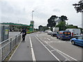
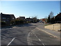
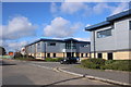
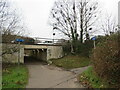
Photos of BH12 4NH
Area Information
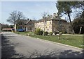
BH12 4NH is a small residential cluster in Poole, Dorset, nestled within the Bournemouth, Christchurch and Poole Council area. The postcode covers 3,554 square metres, housing 1,984 residents in a densely populated area with 558,183 people per square kilometre. This compact community is part of the Newtown and Heatherlands electoral ward, a suburb known for its proximity to Poole’s coastal attractions and transport hubs. Daily life here is shaped by its proximity to key infrastructure, including multiple railway stations and ferry terminals, which connect residents to nearby towns and the Isle of Wight. The area’s population skews towards adults aged 30–64, reflecting a mature demographic with established roots. While the high population density suggests a tight-knit community, the area’s small size means it is best suited for those prioritising accessibility to services and transport over expansive living spaces. Living in BH12 4NH offers a balance of convenience and proximity to amenities, though the compact nature of the area may limit options for larger families or those seeking more open spaces.
- Area Type
- Postcode
- Area Size
- 3554 m²
- Population
- Not available
- Population Density
- Not available
The property market in BH12 4NH is characterised by a high rate of home ownership (69%), with houses being the primary accommodation type. This suggests a market where most properties are owner-occupied, likely reflecting the area’s mature demographic and long-term residency patterns. The small size of the postcode area means the housing stock is limited, with no indication of a significant rental sector. Buyers considering BH12 4NH may find the market competitive, given the high population density and the scarcity of larger properties. The predominance of houses implies that available homes are likely to be family-friendly, though the compact nature of the area may limit options for those seeking more space. Prospective buyers should also consider nearby areas for additional choices, as the immediate surroundings may offer more variety. The high home ownership rate also indicates a stable market, which can be reassuring for long-term investment.
House Prices in BH12 4NH
Showing 1 properties
| Address | Type | Beds | Baths | Last Sale Price | Last Sale Date | |
|---|---|---|---|---|---|---|
| B F I Ltd, Mannings Heath Road, Poole, BH12 4NH | warehouse | - | - | - | - |
Energy Efficiency in BH12 4NH
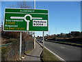
Living in BH12 4NH grants access to a range of amenities within practical reach. Retail options include Asda Rossmore, Tesco Poole, and Co-op Good, providing everyday shopping convenience. The area’s proximity to Poole Quay and its ferry terminals means residents can easily explore the coast, visit Brownsea Island, or travel to the Isle of Wight. Rail stations such as Parkstone and Branksome offer connections to major towns, while nearby airports cater to travel needs. The compact layout ensures that essential services are close by, reducing the need for long commutes. The area’s small size also fosters a community feel, with local shops and transport hubs contributing to a sense of place. For those who enjoy coastal living, the nearby Poole Harbour and surrounding natural landscapes add to the area’s appeal, offering opportunities for recreation and relaxation.
Amenities
Schools
| Rank | School | Type | Entry gender | Ages |
|---|
Explore more schools in this area
Go to Schools tabDemographics
The population of BH12 4NH has a median age of 47, with the majority of residents falling within the 30–64 age range. This suggests a community of middle-aged adults, many of whom may be in their peak working years or nearing retirement. Home ownership is high at 69%, indicating a stable housing market where most residents are long-term occupants rather than renters. The predominant accommodation type is houses, which aligns with the area’s compact layout and likely smaller property sizes. The predominant ethnic group is White, reflecting broader demographic trends in the region. The population density of 558,183 people per square kilometre highlights the area’s high concentration of residents, which can translate to a vibrant, active community but may also mean limited space for expansion. This density supports a strong local economy and social network, though it may impact the availability of larger homes or properties with outdoor space.
Household Size
Accommodation Type
Tenure
Ethnic Group
Religion
Household Composition
Age
Household Deprivation
NS-SEC
Explore more demographic insights in this area
Go to Demographics tabPlanning
Planning Constraints
- Flood RiskPremium
- Ramsar Wetland SitesPremium
- Area of Outstanding Natural BeautyPremium
- Protected Nature ReservePremium
- Protected WoodlandPremium