Area Overview for BH12 4DY
Photos of BH12 4DY
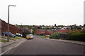
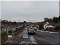
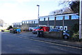
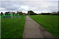
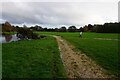
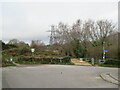
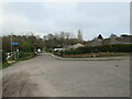
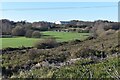
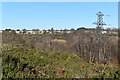
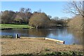
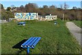
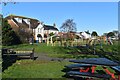
33 photos from this area
Area Information
Key information about the BH12 4DY including its size, population, and administrative classification.
- Area Type
- Postcode
- Area Size
- 1.2 hectares
- Population
- 1791
- Population Density
- 5474 people/km²
House Prices in BH12 4DY
17
Properties
£209,125
Average Sold Price
£157,000
Lowest Price
£317,000
Highest Price
Showing 17 properties
| Address | Type | Beds | Baths | Last Sale Price | Last Sale Date | |
|---|---|---|---|---|---|---|
| 38 Northmere Road, Poole, BH12 4DY | Terraced | 4 | 1 | £317,000 | Dec 2025 | |
| 34 Northmere Road, Poole, BH12 4DY | Terraced | 3 | 1 | £272,000 | Dec 2024 | |
| 42 Northmere Road, Poole, BH12 4DY | Terraced | 3 | 1 | £285,000 | Nov 2022 | |
| 34A Northmere Road, Poole, BH12 4DY | house | - | - | £167,000 | Feb 2021 | |
| 42A Northmere Road, Poole, BH12 4DY | Terraced | 2 | 1 | £182,500 | Nov 2020 | |
| 36 Northmere Road, Poole, BH12 4DY | Terraced | 4 | 1 | £190,000 | Jan 2014 | |
| 19 Northmere Road, Poole, BH12 4DY | Bungalow | - | - | £170,000 | Feb 2013 | |
| 21 Northmere Road, Poole, BH12 4DY | Bungalow | - | - | £185,000 | Sep 2009 | |
| 27 Northmere Road, Poole, BH12 4DY | Detached | - | - | £215,000 | Apr 2008 | |
| 40 Northmere Road, Poole, BH12 4DY | Terraced | - | - | £200,000 | Nov 2007 |
Page 1 of 2
Energy Efficiency in BH12 4DY
Amenities
Schools
| Rank | School | Type | Entry gender | Ages |
|---|
Explore more schools in this area
Go to Schools tabDemographics
Household Size
One person
most common
Accommodation Type
Houses
most common
Tenure
55
majority
Ethnic Group
White
most common
Religion
N/A
most common
Household Composition
N/A
most common
Age
47
median
Adults (30-64 years)
most common
Household Deprivation
N/A
with no deprivation
NS-SEC
23
in Lower managerial occupations
Explore more demographic insights in this area
Go to Demographics tabPlanning
Planning Constraints
- Flood RiskPremium
- Ramsar Wetland SitesPremium
- Area of Outstanding Natural BeautyPremium
- Protected Nature ReservePremium
- Protected WoodlandPremium