Area Overview for BH12 2HN
Photos of BH12 2HN


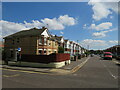
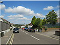
30 photos from this area
Area Information
Key information about the BH12 2HN including its size, population, and administrative classification.
- Area Type
- Postcode
- Area Size
- 1.0 hectares
- Population
- 1791
- Population Density
- 5474 people/km²
House Prices in BH12 2HN
26
Properties
£185,397
Average Sold Price
£104,950
Lowest Price
£300,000
Highest Price
Showing 26 properties
| Address | Type | Beds | Baths | Last Sale Price | Last Sale Date | |
|---|---|---|---|---|---|---|
| 226 Rossmore Road, Poole, BH12 2HN | Semi-detached | 3 | 1 | £225,000 | Nov 2023 | |
| 234 Rossmore Road, Poole, BH12 2HN | house | - | - | £300,000 | Feb 2022 | |
| 242 Rossmore Road, Poole, BH12 2HN | Semi-detached | 2 | 2 | £233,750 | May 2020 | |
| 230 Rossmore Road, Poole, BH12 2HN | house | 3 | - | £193,750 | Aug 2014 | |
| 238 Rossmore Road, Poole, BH12 2HN | Semi-detached | 3 | 1 | £179,950 | Jun 2014 | |
| 214 Rossmore Road, Poole, BH12 2HN | house | 3 | 1 | £200,000 | May 2014 | |
| 216 Rossmore Road, Poole, BH12 2HN | Semi-detached | 3 | 1 | £180,000 | May 2014 | |
| 244 Rossmore Road, Poole, BH12 2HN | Semi-detached | 2 | - | £160,000 | Dec 2013 | |
| 218 Rossmore Road, Poole, BH12 2HN | house | 3 | - | £182,000 | Oct 2013 | |
| 224 Rossmore Road, Poole, BH12 2HN | Semi-detached | 2 | - | £150,000 | Apr 2013 |
Page 1 of 3
Energy Efficiency in BH12 2HN
Amenities
Schools
| Rank | School | Type | Entry gender | Ages |
|---|
Explore more schools in this area
Go to Schools tabDemographics
Household Size
One person
most common
Accommodation Type
Houses
most common
Tenure
55
majority
Ethnic Group
White
most common
Religion
N/A
most common
Household Composition
N/A
most common
Age
47
median
Adults (30-64 years)
most common
Household Deprivation
N/A
with no deprivation
NS-SEC
23
in Lower managerial occupations
Explore more demographic insights in this area
Go to Demographics tabPlanning
Planning Constraints
- Flood RiskPremium
- Ramsar Wetland SitesPremium
- Area of Outstanding Natural BeautyPremium
- Protected Nature ReservePremium
- Protected WoodlandPremium