Area Overview for BH12 1JN
Photos of BH12 1JN
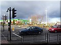
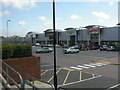
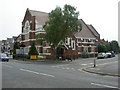
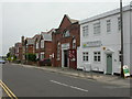


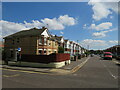
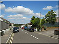
30 photos from this area
Area Information
Key information about the BH12 1JN including its size, population, and administrative classification.
- Area Type
- Postcode
- Area Size
- 1.7 hectares
- Population
- 1438
- Population Density
- 85685 people/km²
House Prices in BH12 1JN
26
Properties
£562,850
Average Sold Price
£78,000
Lowest Price
£2,725,000
Highest Price
Showing 26 properties
| Address | Type | Beds | Baths | Last Sale Price | Last Sale Date | |
|---|---|---|---|---|---|---|
| 10A Yarmouth Road, Poole, BH12 1JN | Flat | 2 | - | £2,725,000 | Mar 2021 | |
| 22 Yarmouth Road, Poole, BH12 1JN | Bungalow | - | - | £285,000 | Aug 2018 | |
| 16 Yarmouth Road, Poole, BH12 1JN | Bungalow | - | - | £232,000 | Sep 2014 | |
| 28 Yarmouth Road, Poole, BH12 1JN | Bungalow | 3 | 1 | £209,950 | Jul 2014 | |
| 24 Yarmouth Road, Poole, BH12 1JN | Bungalow | - | - | £222,000 | Jun 2007 | |
| 20 Yarmouth Road, Poole, BH12 1JN | Bungalow | 2 | 1 | £188,000 | Mar 2006 | |
| 18 Yarmouth Road, Poole, BH12 1JN | Bungalow | 2 | 1 | £78,000 | Sep 1998 | |
| 14, Yarmouth Court, 6 Yarmouth Road, Poole, BH12 1JN | Flat | 2 | 1 | - | - | |
| 10 Yarmouth Road, Poole, BH12 1JN | Flat | 2 | 1 | - | - | |
| 10, Yarmouth Court, 6 Yarmouth Road, Poole, BH12 1JN | Flat | 2 | 1 | - | - |
Page 1 of 3
Energy Efficiency in BH12 1JN
Amenities
Schools
| Rank | School | Type | Entry gender | Ages |
|---|
Explore more schools in this area
Go to Schools tabDemographics
Household Size
Two person
most common
Accommodation Type
Houses
most common
Tenure
74
majority
Ethnic Group
White
most common
Religion
N/A
most common
Household Composition
N/A
most common
Age
47
median
Adults (30-64 years)
most common
Household Deprivation
N/A
with no deprivation
NS-SEC
43
in Lower managerial occupations
Explore more demographic insights in this area
Go to Demographics tabPlanning
Planning Constraints
- Flood RiskPremium
- Ramsar Wetland SitesPremium
- Area of Outstanding Natural BeautyPremium
- Protected Nature ReservePremium
- Protected WoodlandPremium