Area Overview for BH11 9YJ
Photos of BH11 9YJ


Area Information
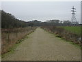
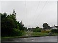
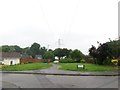
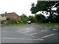
Living in BH11 9YJ means being part of a small, tightly knit residential cluster within the Bearwood & Merley ward of Bournemouth, Christchurch, and Poole. This postcode area, covering 17.55 km², is home to 1364 residents, reflecting a modest population density. The area is part of a broader suburban network in Dorset, with Bearwood and Merley forming its core. Proximity to key transport hubs, including multiple railway stations and ferry terminals, ensures connectivity to nearby towns and coastal attractions. Daily life here balances suburban tranquillity with access to retail, dining, and leisure options. The low population density suggests a community-oriented environment, where residents may know their neighbours and share a sense of local identity. While the area is not a major urban centre, its strategic location near Bournemouth Airport and Poole Quay makes it appealing for commuters and those seeking a mix of rural and urban living. The absence of significant environmental constraints, such as protected woodlands or AONB designations, means development is not restricted, offering potential for future growth.
- Area Type
- Postcode
- Area Size
- Not available
- Population
- 1364
- Population Density
- 3922 people/km²
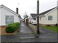
The property market in BH11 9YJ is characterised by a high rate of home ownership (85%) and a focus on houses rather than flats or apartments. This suggests a market dominated by owner-occupied properties, likely catering to families and professionals seeking stable, long-term housing. The prevalence of houses indicates a suburban or semi-rural setting, with larger properties that may appeal to buyers prioritising space and privacy. Given the small size of the postcode area and its integration into the wider Bearwood & Merley ward, the local market may be limited in scale but could benefit from proximity to Bournemouth’s amenities. Buyers should consider the area’s potential for growth, though its small size means competition for properties may be limited. The lack of rental properties in the data implies a community where homeownership is the norm, which could influence property values and market dynamics.
House Prices in BH11 9YJ
No properties found in this postcode.
Energy Efficiency in BH11 9YJ
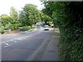
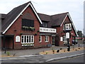
Residents of BH11 9YJ have access to a range of retail and leisure amenities within practical reach. The Southern Co-operative Co, Tesco Bear, and Morrisons Daily provide everyday shopping needs, while nearby railway stations offer easy access to Bournemouth’s cultural and commercial hubs. The proximity to Bournemouth Airport and Poole Quay adds convenience for travel, whether for business or leisure. Ferries to Poole Quay and Brownsea Island offer scenic routes and opportunities for coastal activities. The area’s mix of retail, transport, and travel options supports a balanced lifestyle, blending suburban comfort with urban connectivity. The presence of multiple railway stations and ferry terminals also suggests a community that values mobility and accessibility, making BH11 9YJ suitable for those seeking a mix of convenience and tranquillity.
Amenities
Schools
| Rank | School | Type | Entry gender | Ages |
|---|
Explore more schools in this area
Go to Schools tabDemographics
The population of BH11 9YJ is predominantly adults aged 30–64, with a median age of 47. This suggests a community of established professionals, families, and retirees, with fewer young children or elderly residents compared to other areas. Home ownership is high at 85%, indicating a stable, long-term resident base. The accommodation type is primarily houses, reflecting a preference for single-family dwellings over flats or apartments. The predominant ethnic group is White, with no data provided on other demographics. The age profile and ownership figures imply a mature, settled population, likely with strong community ties. The absence of specific data on deprivation or diversity means the area’s social fabric is not fully quantified, but the high home ownership and median age suggest a relatively affluent, low-turnover environment.
Household Size
Accommodation Type
Tenure
Ethnic Group
Religion
Household Composition
Age
Household Deprivation
NS-SEC
Explore more demographic insights in this area
Go to Demographics tabPlanning
Planning Constraints
- Flood RiskPremium
- Ramsar Wetland SitesPremium
- Area of Outstanding Natural BeautyPremium
- Protected Nature ReservePremium
- Protected WoodlandPremium