Area Overview for BH11 9YE
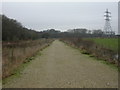
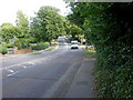
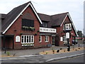
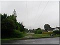
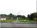
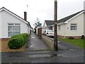
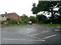
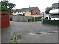
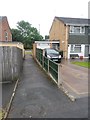
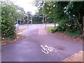
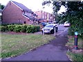
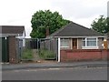
Photos of BH11 9YE
Area Information
BH11 9YE lies within the Bearwood & Merley ward of Bournemouth, Christchurch, and Poole Council, a small residential cluster in Dorset. With a population of 1,384, the area is part of a 17.55 km² ward that includes Bearwood and Merley suburbs. The postcode covers a compact, well-defined community served by postcodes like BH11 8NA. The area’s character is shaped by its proximity to coastal and urban amenities, with a mix of local services and transport links. Residents benefit from being near Bournemouth’s main rail stations, airports, and ferry terminals, which connect them to both regional and national networks. The ward was established in 2019, merging previous administrative boundaries, and its density of 799.1/km² reflects a mix of residential and semi-rural living. Living here offers a balance of quiet neighbourhoods and accessible infrastructure, making it suitable for those seeking a settled, community-focused environment without sacrificing connectivity.
- Area Type
- Postcode
- Area Size
- Not available
- Population
- 1384
- Population Density
- 3290 people/km²
BH11 9YE is predominantly an owner-occupied area, with 91% of homes owned by residents rather than rented. The accommodation type is exclusively houses, which suggests a focus on single-family homes rather than flats or apartments. This composition indicates a market tailored to families or individuals seeking private, long-term housing. Given the high home ownership rate and the area’s small size, the housing stock is likely limited, meaning buyers may need to consider nearby postcodes for more options. The presence of houses also implies lower density development, which can appeal to those prioritising space and privacy. For buyers, this area offers a stable market with minimal rental activity, though competition for properties may be keen due to its limited size and desirability.
House Prices in BH11 9YE
No properties found in this postcode.
Energy Efficiency in BH11 9YE
The lifestyle in BH11 9YE is supported by a range of nearby amenities within practical reach. Retail options include Tesco Bear, The Southern Co-operative Co, and Morrisons Daily, providing daily essentials and convenience. The area’s proximity to rail stations, airports, and ferry terminals enhances mobility, allowing easy access to urban centres, coastal attractions, and regional hubs. While the data does not specify parks or leisure facilities, the presence of multiple transport links suggests opportunities for outdoor activities in nearby areas. The combination of local shops and diverse transport options ensures a balanced lifestyle, blending community convenience with broader connectivity. This makes BH11 9YE appealing to those who value accessibility without compromising on residential tranquillity.
Amenities
Schools
| Rank | School | Type | Entry gender | Ages |
|---|
Explore more schools in this area
Go to Schools tabDemographics
The population of BH11 9YE is 1,384, with a median age of 47, indicating a mature demographic. The most common age range is elderly (65+ years), suggesting a community with a significant proportion of long-term residents. Home ownership is exceptionally high at 91%, reflecting a stable, owner-occupied area. The predominant accommodation type is houses, which aligns with the older age profile and likely reflects family-oriented living. The predominant ethnic group is White, which is consistent with broader regional demographics. This data implies a low turnover of residents and a focus on established households. The absence of specific deprivation data means the area’s quality of life is likely supported by its high home ownership and proximity to essential services, though further local studies would clarify socioeconomic nuances.
Household Size
Accommodation Type
Tenure
Ethnic Group
Religion
Household Composition
Age
Household Deprivation
NS-SEC
Explore more demographic insights in this area
Go to Demographics tabPlanning
Planning Constraints
- Flood RiskPremium
- Ramsar Wetland SitesPremium
- Area of Outstanding Natural BeautyPremium
- Protected Nature ReservePremium
- Protected WoodlandPremium