Area Overview for BH11 9QB
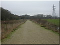
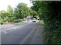
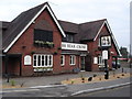
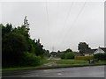
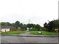
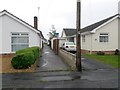
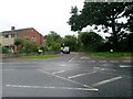
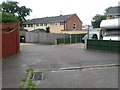
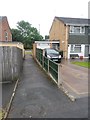
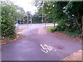
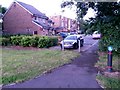
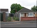
Photos of BH11 9QB
Area Information
Bearwood and Merley forms a recognised ward within Bournemouth, Christchurch and Poole Council, encapsulating the BH11 9QB postcode area as a distinct residential cluster. This small locality covers 1.1 hectares and serves a population of 1384 residents. Life here is defined by a high degree of quietude, typical of a compact suburban environment where neighbours can readily interact within such a confined space. The area sits on the edge of a larger unitary authority ward that spans 17.55 km², yet it retains its own identity as a tightly packed community. Residents enjoy proximity to the wider suburbs of Bearwood and Merley without being overwhelmed by urban density. The ward was established in 2019, combining the former separate Merley and Bearwood wards to create this current administrative boundary. Living in BH11 9QB means belonging to a stable community with deep roots in the South West of England. You can expect a domestic atmosphere coloured by traditional settlement patterns rather than rapid development. The location offers a practical residential setting for those seeking a smaller neighbourhood within the wider Dorset locality.
- Area Type
- Postcode
- Area Size
- 1.1 hectares
- Population
- 1384
- Population Density
- 3290 people/km²
Homes in BH11 9QB exist within a market characterised by traditional ownership rather than renting. The accommodation type is exclusively houses, which defines the physical landscape of this small residential cluster. With home ownership standing at 91%, the vast majority of properties are held by residents rather than investment trusts or letting agencies. This statistic signals a stable housing stock where people remain in their homes for extended periods. Buying into this postcode sector implies joining a community of current owners who typically understand the value of long-term stability. The absence of flats or apartments means the local market caters to buyers seeking detached or semi-detached family or retirement properties. You will encounter a scarcity of rental options compared to other urban areas, reflecting the dominance of owner-occupiers. The 1384 people living here share a direct stake in the upkeep of their surroundings. The density of 123350 people per square kilometre is artificially high due to the small measurement of the postcode area; the wider ward operates at a much lower density of 799.1 per km². When assessing property values, consider that the local market relies heavily on the conservation and maintenance of existing house types.
House Prices in BH11 9QB
Showing 19 properties
| Address | Type | Beds | Baths | Last Sale Price | Last Sale Date | |
|---|---|---|---|---|---|---|
| 36 Weldon Avenue, Bournemouth, BH11 9QB | Bungalow | 2 | 1 | £300,000 | May 2018 | |
| 40 Weldon Avenue, Bournemouth, BH11 9QB | Bungalow | 2 | 1 | £302,950 | Oct 2016 | |
| 22 Weldon Avenue, Bournemouth, BH11 9QB | Bungalow | 2 | 1 | £272,000 | Aug 2016 | |
| 28 Weldon Avenue, Bournemouth, BH11 9QB | Bungalow | 2 | - | £250,000 | Dec 2013 | |
| 14 Weldon Avenue, Bournemouth, BH11 9QB | Bungalow | 3 | 1 | £215,000 | Dec 2013 | |
| 16 Weldon Avenue, Bournemouth, BH11 9QB | Bungalow | - | - | £260,000 | Oct 2011 | |
| 38 Weldon Avenue, Bournemouth, BH11 9QB | Bungalow | - | - | £219,500 | Apr 2004 | |
| 34 Weldon Avenue, Bournemouth, BH11 9QB | Detached | - | - | £154,000 | May 2002 | |
| 20 Weldon Avenue, Bournemouth, BH11 9QB | Detached | - | - | £116,000 | Jan 2001 | |
| 26 Weldon Avenue, Bournemouth, BH11 9QB | Bungalow | 3 | 1 | £134,000 | Aug 1999 |
Energy Efficiency in BH11 9QB
Daily life in BH11 9QB benefits from immediate access to a range of essential retail and leisure facilities. You can shop at The Southern Co-operative Co, Tesco Bear, or Morrisons Daily, all located within practical reach of the 1.1 hectare residential cluster. These stores provide everything from groceries to general household necessities without requiring long journeys. Travelers or residents wishing to explore further can utilise nearby transport links to reach key destinations. Branksome Railway Station and Parkstone Railway Station offer rail connections to wider networks. Bournemouth Ferry Terminal allows you to travel to Brownsea Island easily. Bournemouth International Airport is also situated nearby for flying distances. The area research notes that the wider Bearwood and Merley ward covers 17.55 km², suggesting a larger ecosystem of amenities surrounding your immediate neighbourhod. You will find yourself in a setting where daily provisions are close by. The presence of three named supermarkets indicates a well-served retail environment. Commute times to city centres or coastal towns are manageable given the density of train stations and ferry landings. The lifestyle here balances convenience with the quiet of a small postcode area.
Amenities
Schools
| Rank | School | Type | Entry gender | Ages |
|---|
Explore more schools in this area
Go to Schools tabDemographics
The population of BH11 9QB reflects a distinct demographic profile centred on later life. The median age stands at 47, while the elderly population aged 65 years and over constitutes the most common age range in this specific postcode sector. This age skew suggests a community where families may have long since moved on or where retirement housing attracts owners. House ownership is exceptionally high, reaching 91% of all households. This figure indicates a neighbourhood where residents have secured their homes through purchase rather than renting. The predominant ethnic group is White, aligning with broader trends in many established English suburbs. You will find a housing stock dominated entirely by houses, with no record of flats or apartment blocks within this 1.1 hectare area. The demographic makeup suggests a settled village feel rather than a transient, student-heavy hub. The high ownership rate combined with an older age profile creates a stable environment where long-term residents are likely to remain. When considering homes in BH11 9QB, you are largely dealing with existing owners rather than private landlords.
Household Size
Accommodation Type
Tenure
Ethnic Group
Religion
Household Composition
Age
Household Deprivation
NS-SEC
Explore more demographic insights in this area
Go to Demographics tabPlanning
Planning Constraints
- Flood RiskPremium
- Ramsar Wetland SitesPremium
- Area of Outstanding Natural BeautyPremium
- Protected Nature ReservePremium
- Protected WoodlandPremium