Area Overview for BH11 9HW
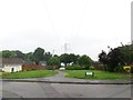
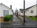
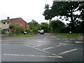
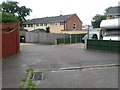
Photos of BH11 9HW
Area Information
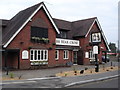
Kinson Ward, identified by the postcode BH11 9HW, defines a compact residential cluster within Bournemouth. This specific site covers just 1.5 hectares yet supports a population of 1,384 residents. Living in BH11 9HW means inhabiting a small, tightly knit neighbourhood that retains the historical footprint of Kinson, a village absorbed into the County Borough of Bournemouth on 8th April 1931. The area sits near the main road between Wimborne and Bournemouth, a route established long before Saxon times that continues to shape the local geography. You are not moving into a vast sprawl but a defined community where approximately 9,144 people per square kilometre reside. This density creates a close-knit environment where the original character of Kinson, perhaps recognised by historic landmarks like Pelhams or St Andrews Church, remains visible. Daily life here is grounded in proximity to key transport hubs like Bournemouth Railway Station and Poole Quay Ferry Landing. You gain direct access to Bournemouth International Airport and Brownsea Island Ferry Landing without traversing large distances. Homes in BH11 9HW offer a connection to a region with deep historical roots, available right now for those seeking a location with both heritage and modern connectivity.
- Area Type
- Postcode
- Area Size
- 1.5 hectares
- Population
- 1384
- Population Density
- 3290 people/km²
Buying a home in BH11 9HW enters a market dominated by existing ownership. With 91% of properties in this cluster owned by residents, the local estate is characterised by stability and long-term occupation. The accommodation type is listed as houses, confirming that you will find a stock comprising predominantly detached or semi-detached structures rather than apartments. This concentration of houses aligns with the historical development of Kinson Ward, where land allotted during the 1805 Canford Enclosure Act shaped the current residential layout. When you look at homes in BH11 9HW, you are viewing properties that often reflect the ward's evolution from a separate village to a district of Bournemouth. The high ownership rate suggests these homes attract buyers seeking to put down roots, which can affect pricing and resale dynamics. You are likely to encounter a market with fewer new-build developments compared to larger metropolitan areas, as the 1.5-hectare size limits large-scale regeneration projects. Instead, the property market here relies on private sales of established stock. For a buyer, this means evaluating individual properties based on their specific condition and location within the cluster near Turbary Common or the main thoroughfare. The low population density relative to some UK cities, combined with the house-centric stock, creates a distinct property environment focused on traditional residential living.
House Prices in BH11 9HW
Showing 27 properties
| Address | Type | Beds | Baths | Last Sale Price | Last Sale Date | |
|---|---|---|---|---|---|---|
| 6 Exbury Drive, Bournemouth, BH11 9HW | Bungalow | - | - | £305,000 | May 2018 | |
| 15 Exbury Drive, Bournemouth, BH11 9HW | Bungalow | 2 | 1 | £240,000 | Apr 2018 | |
| 17 Exbury Drive, Bournemouth, BH11 9HW | Bungalow | 3 | - | £252,000 | Mar 2017 | |
| 9 Exbury Drive, Bournemouth, BH11 9HW | Bungalow | 2 | - | £240,000 | Jul 2015 | |
| 2 Exbury Drive, Bournemouth, BH11 9HW | Bungalow | 2 | - | £285,000 | Nov 2014 | |
| 26 Exbury Drive, Bournemouth, BH11 9HW | Bungalow | 2 | - | £247,750 | Sep 2014 | |
| 20 Exbury Drive, Bournemouth, BH11 9HW | Bungalow | 2 | - | £250,000 | Sep 2014 | |
| 24 Exbury Drive, Bournemouth, BH11 9HW | Bungalow | 2 | - | £215,000 | Jul 2012 | |
| 19 Exbury Drive, Bournemouth, BH11 9HW | Bungalow | - | - | £200,000 | Sep 2011 | |
| 5 Exbury Drive, Bournemouth, BH11 9HW | Bungalow | - | - | £196,500 | Jan 2010 |
Energy Efficiency in BH11 9HW
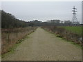
Living in BH11 9HW grants you immediate access to a variety of retail and leisure options. Within practical reach, you can visit five major retail outlets, including Tesco Bear, The Southern Co-operative Co, and Lidl Bear. These supermarkets provide daily essentials without the need for lengthy car journeys. Transport accessibility is a defining feature of your lifestyle, with five railway stations nearby, most notably Branksome Railway Station, Parkstone Railway Station, and Bournemouth Railway Station. If your interests lie in travel, Bournemouth Airport and Bournemouth International Airport are just minutes away, alongside five ferry services connecting you to Poole Quay Ferry Landing, Poole Ferry Terminal, and Brownsea Island Ferry Landing. Historically, the area includes significant green space such as Turbary Common, a public space established during the 1805 enclosure that survives to the present day. You can enjoy walks or picnics here, sustaining the connection to nature found in the ward. Community life often centres around local history landmarks like St Andrews Church and the historic building Pelhams. The proximity to these facilities ensures that culture and nature are woven into daily routines. Whether you shop at Lidl Bear, commute via Parkstone Railway Station, or relax by Turbary Common, your daily life in BH11 9HW blends practical convenience with the calm of a historic ward.
Amenities
Schools
| Rank | School | Type | Entry gender | Ages |
|---|
Explore more schools in this area
Go to Schools tabDemographics
The community profile for BH11 9HW reflects a settled, mature population. Almost half of the residents are aged 50 or over, with the 55 to 64 age group being the single largest cohort. Specifically, the most common age range comprises the elderly, defined here as those 65 years and older. This age distribution shapes the daily rhythm of the ward, suggesting a neighbourhood where long-term stability is the norm. Home ownership stands at an impressive 91%, meaning almost nine out of ten households own their property outright. Such high ownership levels indicate that the area attracts families and individuals looking to settle permanently rather than rent. The predominant ethnic group is White, reflecting the traditional demographic composition of the ward. Since the accommodation type consists primarily of houses, you can expect a streetscape dominated by detached or semi-detached residences rather than high-rise flats. This aligns perfectly with the older age profile, as single-level homes are often preferred by those in their later years. Deprivation data is not included in the current profile, so the focus remains on clear indicators of stability: high ownership and an established population. Living in BH11 9HW means joining a community where the majority of neighbours have likely called their local schools and places of worship home for decades.
Household Size
Accommodation Type
Tenure
Ethnic Group
Religion
Household Composition
Age
Household Deprivation
NS-SEC
Explore more demographic insights in this area
Go to Demographics tabPlanning
Planning Constraints
- Flood RiskPremium
- Ramsar Wetland SitesPremium
- Area of Outstanding Natural BeautyPremium
- Protected Nature ReservePremium
- Protected WoodlandPremium