Area Overview for BH11 8ZD
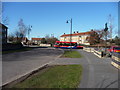
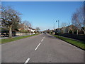
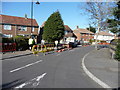
Photos of BH11 8ZD

Area Information
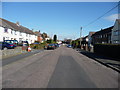
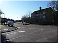
BH11 8ZD is a small residential postcode area in Bournemouth, part of the Kinson Ward, which has a population of around 1,813. The area is historically rooted, with origins dating back to Saxon times, though it was incorporated into Bournemouth in 1931. Today, it is a quiet, low-density cluster of homes, centred around the main road linking Wimborne and Bournemouth. The community is characterised by its mature demographic, with a median age of 47 and a majority of residents aged 30–64. Daily life here is defined by proximity to retail, transport, and natural spaces. Residents benefit from nearby rail stations, including Branksome and Bournemouth, as well as ferry services to Poole and Brownsea Island. The area’s compact size means most amenities are within walking or cycling distance, though its small population suggests a close-knit, localised feel. For buyers, BH11 8ZD offers a blend of historical charm and practical modern connectivity, though its limited housing stock means opportunities are niche.
- Area Type
- Postcode
- Area Size
- Not available
- Population
- Not available
- Population Density
- Not available
BH11 8ZD is a small area with a limited housing stock, primarily composed of houses rather than flats or apartments. With 40% of properties owner-occupied, the market skews more towards private buyers than renters, though the relatively low home ownership rate suggests a significant portion of the housing stock is rented out. The predominance of houses indicates a focus on family homes or larger properties, which may appeal to buyers seeking space but could limit options in a constrained area. Given the postcode’s size, property availability is limited, and buyers may need to consider nearby wards for broader choices. The market’s character is defined by its historical roots and low-density layout, offering a contrast to more urbanised parts of Bournemouth.
House Prices in BH11 8ZD
No properties found in this postcode.
Energy Efficiency in BH11 8ZD
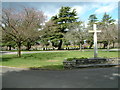
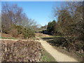
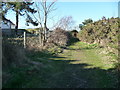
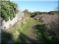
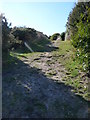
The lifestyle in BH11 8ZD is shaped by its proximity to retail, transport, and natural spaces. Local shops include Farmfoods Bournemouth, Lidl Bear, and Morrisons Daily, offering everyday essentials. The area’s rail links, such as Branksome and Bournemouth stations, provide easy access to larger towns and cities, while nearby airports and ferry terminals open up travel opportunities. Public spaces like Turbary Common, a remnant of 1805 enclosures, offer green space for leisure. The combination of practical retail, transport, and accessible nature makes daily life convenient, though the area’s small size means some amenities require a short trip. The presence of historic sites like St Andrews Church adds a layer of local character, blending practicality with heritage.
Amenities
Schools
The area is served by three primary schools: Heathlands Junior School, Heathlands Primary School, and Heathlands Primary Academy, which holds an Ofsted rating of ‘good’. These schools provide a range of primary education options, though no secondary schools are listed in the data. The presence of multiple primary schools suggests a family-friendly environment, with proximity to education a key consideration for buyers. However, families requiring secondary schooling may need to look beyond BH11 8ZD, as the area’s small size and focus on primary education imply limited local provision for older children. The ‘good’ rating at Heathlands Primary Academy indicates at least one institution meets high standards, but the overall school mix lacks diversity in type or age range.
| Rank | School | Type | Entry gender | Ages |
|---|
Explore more schools in this area
Go to Schools tabDemographics
The population of BH11 8ZD is 1,525, with a median age of 47, indicating a mature community. The most common age group is adults aged 30–64, reflecting a stable, long-term resident base. Home ownership sits at 40%, with houses being the predominant accommodation type. This suggests a mix of owner-occupied properties and rentals, though the lower ownership rate may indicate a reliance on private rental markets. The predominant ethnic group is White, with no specific data on diversity beyond this. The area’s demographics align with a settled, middle-aged population, likely with families or professionals seeking a quieter, established environment. The lack of detailed diversity metrics means the community’s cultural composition remains underexplored in available data.
Household Size
Accommodation Type
Tenure
Ethnic Group
Religion
Household Composition
Age
Household Deprivation
NS-SEC
Explore more demographic insights in this area
Go to Demographics tabPlanning
Planning Constraints
- Flood RiskPremium
- Ramsar Wetland SitesPremium
- Area of Outstanding Natural BeautyPremium
- Protected Nature ReservePremium
- Protected WoodlandPremium